Area Overview for CH4 0PE
Photos of CH4 0PE
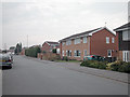
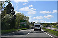
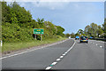
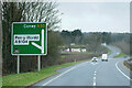
19 photos from this area
Area Information
Key information about the CH4 0PE including its size, population, and administrative classification.
- Area Type
- Postcode
- Area Size
- 1.3 hectares
- Population
- 2271
- Population Density
- 246 people/km²
House Prices in CH4 0PE
42
Properties
£109,632
Average Sold Price
£39,000
Lowest Price
£195,000
Highest Price
Showing 42 properties
| Address | Type | Beds | Baths | Last Sale Price | Last Sale Date | |
|---|---|---|---|---|---|---|
| 11 Wellington Road, Broughton, CH4 0PE | Semi-detached | 3 | 1 | £195,000 | Jan 2025 | |
| 7 Wellington Road, Broughton, CH4 0PE | Semi-detached | 3 | 1 | £186,000 | Nov 2024 | |
| 25 Wellington Road, Broughton, CH4 0PE | Terraced | 4 | - | £180,000 | Mar 2023 | |
| 61 Wellington Road, Broughton, CH4 0PE | house | - | - | £130,000 | Feb 2022 | |
| 29 Wellington Road, Broughton, CH4 0PE | house | - | - | £145,500 | Sep 2021 | |
| 75 Wellington Road, Broughton, CH4 0PE | Semi-detached | - | - | £110,000 | Jun 2021 | |
| 81 Wellington Road, Broughton, CH4 0PE | Terraced | 2 | 1 | £93,000 | Jun 2021 | |
| 17 Wellington Road, Broughton, CH4 0PE | house | - | - | £85,000 | Dec 2019 | |
| 53 Wellington Road, Broughton, CH4 0PE | Terraced | 3 | - | £103,500 | Aug 2017 | |
| 5 Wellington Road, Broughton, CH4 0PE | Bungalow | - | - | £115,500 | May 2016 |
Page 1 of 5
Energy Efficiency in CH4 0PE
Amenities
Schools
| Rank | School | Type | Entry gender | Ages |
|---|
Explore more schools in this area
Go to Schools tabDemographics
Household Size
Two person
most common
Accommodation Type
Houses
most common
Tenure
73
majority
Ethnic Group
White
most common
Religion
N/A
most common
Household Composition
N/A
most common
Age
47
median
Adults (30-64 years)
most common
Household Deprivation
N/A
with no deprivation
NS-SEC
32
in Lower managerial occupations
Explore more demographic insights in this area
Go to Demographics tabPlanning
Planning Constraints
- Flood RiskPremium
- Ramsar Wetland SitesPremium
- Area of Outstanding Natural BeautyPremium
- Protected Nature ReservePremium
- Protected WoodlandPremium
- Crime RiskPremium