Area Overview for CH4 0NR
Photos of CH4 0NR
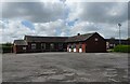
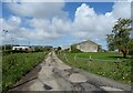
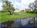
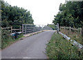
19 photos from this area
Area Information
Key information about the CH4 0NR including its size, population, and administrative classification.
- Area Type
- Postcode
- Area Size
- 1.6 hectares
- Population
- 2271
- Population Density
- 246 people/km²
House Prices in CH4 0NR
42
Properties
£132,311
Average Sold Price
£35,000
Lowest Price
£310,000
Highest Price
Showing 42 properties
| Address | Type | Beds | Baths | Last Sale Price | Last Sale Date | |
|---|---|---|---|---|---|---|
| 93 Main Road, Broughton, CH4 0NR | Terraced | 2 | 1 | £187,000 | Sep 2025 | |
| 59 Main Road, Broughton, CH4 0NR | Semi-detached | 3 | 1 | £141,000 | Jul 2025 | |
| 141 Main Road, Broughton, CH4 0NR | Terraced | 3 | 1 | £145,000 | Nov 2024 | |
| 97 Main Road, Broughton, CH4 0NR | Terraced | 2 | 1 | £165,500 | Oct 2022 | |
| 145 Main Road, Broughton, CH4 0NR | Terraced | 2 | 1 | £140,500 | May 2022 | |
| 111 Main Road, Broughton, CH4 0NR | house | - | - | £142,500 | Dec 2021 | |
| 85 Main Road, Broughton, CH4 0NR | Semi-detached | 5 | 3 | £310,000 | Sep 2021 | |
| 105 Main Road, Broughton, CH4 0NR | house | - | - | £169,950 | Sep 2021 | |
| 95 Main Road, Broughton, CH4 0NR | Terraced | 3 | 1 | £134,000 | Feb 2021 | |
| 101 Main Road, Broughton, CH4 0NR | Terraced | 3 | 2 | £145,000 | Dec 2020 |
Page 1 of 5
Energy Efficiency in CH4 0NR
Amenities
Schools
| Rank | School | Type | Entry gender | Ages |
|---|
Explore more schools in this area
Go to Schools tabDemographics
Household Size
Two person
most common
Accommodation Type
Houses
most common
Tenure
73
majority
Ethnic Group
White
most common
Religion
N/A
most common
Household Composition
N/A
most common
Age
47
median
Adults (30-64 years)
most common
Household Deprivation
N/A
with no deprivation
NS-SEC
32
in Lower managerial occupations
Explore more demographic insights in this area
Go to Demographics tabPlanning
Planning Constraints
- Flood RiskPremium
- Ramsar Wetland SitesPremium
- Area of Outstanding Natural BeautyPremium
- Protected Nature ReservePremium
- Protected WoodlandPremium
- Crime RiskPremium