Area Overview for LL18 6AU
Photos of LL18 6AU


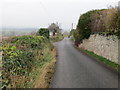

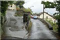
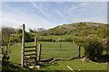
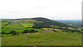
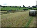
21 photos from this area
Area Information
Key information about the LL18 6AU including its size, population, and administrative classification.
- Area Type
- Postcode
- Area Size
- 12.7 hectares
- Population
- 1282
- Population Density
- 563 people/km²
House Prices in LL18 6AU
56
Properties
£165,726
Average Sold Price
£32,500
Lowest Price
£392,000
Highest Price
Showing 56 properties
| Address | Type | Beds | Baths | Last Sale Price | Last Sale Date | |
|---|---|---|---|---|---|---|
| Bryn Aled, 46 Lower Foel Road, Dyserth, Rhyl, LL18 6AU | house | 3 | 2 | £220,000 | Aug 2024 | |
| Sitka, 50 Lower Foel Road, Dyserth, Rhyl, LL18 6AU | Bungalow | 4 | 2 | £305,000 | Jan 2024 | |
| Isfryn, 33 Lower Foel Road, Dyserth, Rhyl, LL18 6AU | Terraced | 2 | 1 | £177,000 | Dec 2023 | |
| Bay View, 28 Lower Foel Road, Dyserth, Rhyl, LL18 6AU | house | - | - | £215,000 | Nov 2023 | |
| Weatherstone Cottage, 31 Lower Foel Road, Dyserth, Rhyl, LL18 6AU | house | 1 | 1 | £138,000 | Aug 2023 | |
| Noir Mont, 38 Lower Foel Road, Dyserth, Rhyl, LL18 6AU | Semi-detached | 3 | 1 | £270,000 | Aug 2023 | |
| Cobweb Cottage, 71 Lower Foel Road, Dyserth, Rhyl, LL18 6AU | house | 4 | - | £392,000 | Jun 2023 | |
| Elderflower Cottage, 57 Lower Foel Road, Dyserth, Rhyl, LL18 6AU | house | - | - | £180,250 | Feb 2023 | |
| Hafan Wen, 83 Lower Foel Road, Dyserth, Rhyl, LL18 6AU | Bungalow | 3 | 1 | £220,000 | Oct 2022 | |
| Esmor Cottage, 39 Lower Foel Road, Dyserth, Rhyl, LL18 6AU | house | - | - | £151,000 | Dec 2021 |
Page 1 of 6
Energy Efficiency in LL18 6AU
Amenities
Schools
| Rank | School | Type | Entry gender | Ages |
|---|
Explore more schools in this area
Go to Schools tabDemographics
Household Size
Two person
most common
Accommodation Type
Houses
most common
Tenure
84
majority
Ethnic Group
White
most common
Religion
N/A
most common
Household Composition
N/A
most common
Age
47
median
Adults (30-64 years)
most common
Household Deprivation
N/A
with no deprivation
NS-SEC
40
in Lower managerial occupations
Explore more demographic insights in this area
Go to Demographics tabPlanning
Planning Constraints
- Flood RiskPremium
- Ramsar Wetland SitesPremium
- Area of Outstanding Natural BeautyPremium
- Protected Nature ReservePremium
- Protected WoodlandPremium
- Crime RiskPremium