Area Overview for LL18 6AN
Photos of LL18 6AN
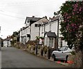
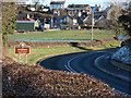
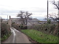
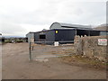
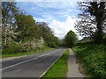


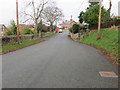
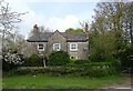
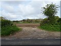
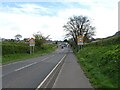
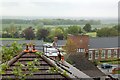
13 photos from this area
Area Information
Key information about the LL18 6AN including its size, population, and administrative classification.
- Area Type
- Postcode
- Area Size
- 2.1 hectares
- Population
- 1282
- Population Density
- 563 people/km²
House Prices in LL18 6AN
18
Properties
£148,272
Average Sold Price
£59,950
Lowest Price
£327,500
Highest Price
Showing 18 properties
| Address | Type | Beds | Baths | Last Sale Price | Last Sale Date | |
|---|---|---|---|---|---|---|
| Evencroft, Thomas Avenue, Dyserth, Rhyl, LL18 6AN | house | - | - | £165,000 | Jun 2022 | |
| Bingley, Thomas Avenue, Dyserth, Rhyl, LL18 6AN | Bungalow | 3 | - | £244,000 | Sep 2020 | |
| Llys Helyg, Thomas Avenue, Dyserth, Rhyl, LL18 6AN | Detached | 5 | 2 | £327,500 | Dec 2018 | |
| Fron, Thomas Avenue, Dyserth, Rhyl, LL18 6AN | Bungalow | 2 | 1 | £110,000 | Dec 2009 | |
| Deheufor, Thomas Avenue, Dyserth, Rhyl, LL18 6AN | house | - | - | £155,000 | Jul 2009 | |
| Bryn Awel, Thomas Avenue, Dyserth, Rhyl, LL18 6AN | Detached | - | - | £150,000 | Sep 2008 | |
| Llys Aled, Thomas Avenue, Dyserth, Rhyl, LL18 6AN | Semi-detached | - | - | £59,950 | Sep 2001 | |
| Plas Newydd, Thomas Avenue, Dyserth, Rhyl, LL18 6AN | Detached | 4 | 2 | £63,000 | Jun 2001 | |
| Police House, Thomas Avenue, Dyserth, Rhyl, LL18 6AN | house | - | - | £59,999 | Aug 1996 | |
| Greigwood, Thomas Avenue, Dyserth, Rhyl, LL18 6AN | Bungalow | - | - | - | - |
Page 1 of 2
Energy Efficiency in LL18 6AN
Amenities
Schools
| Rank | School | Type | Entry gender | Ages |
|---|
Explore more schools in this area
Go to Schools tabDemographics
Household Size
Two person
most common
Accommodation Type
Houses
most common
Tenure
84
majority
Ethnic Group
White
most common
Religion
N/A
most common
Household Composition
N/A
most common
Age
47
median
Adults (30-64 years)
most common
Household Deprivation
N/A
with no deprivation
NS-SEC
40
in Lower managerial occupations
Explore more demographic insights in this area
Go to Demographics tabPlanning
Planning Constraints
- Flood RiskPremium
- Ramsar Wetland SitesPremium
- Area of Outstanding Natural BeautyPremium
- Protected Nature ReservePremium
- Protected WoodlandPremium
- Crime RiskPremium