Area Overview for LL18 6AT
Photos of LL18 6AT
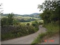
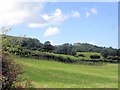
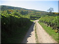
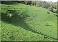
21 photos from this area
Area Information
Key information about the LL18 6AT including its size, population, and administrative classification.
- Area Type
- Postcode
- Area Size
- 9577 m²
- Population
- 1282
- Population Density
- 563 people/km²
House Prices in LL18 6AT
19
Properties
£151,100
Average Sold Price
£52,000
Lowest Price
£240,000
Highest Price
Showing 19 properties
| Address | Type | Beds | Baths | Last Sale Price | Last Sale Date | |
|---|---|---|---|---|---|---|
| Plemont, 8 Lower Foel Road, Dyserth, Rhyl, LL18 6AT | house | - | - | £225,000 | Nov 2022 | |
| Clwyd Vale View, 7 Lower Foel Road, Dyserth, Rhyl, LL18 6AT | Semi-detached | 3 | 1 | £185,000 | Jul 2022 | |
| Woodcroft, 22 Lower Foel Road, Dyserth, Rhyl, LL18 6AT | Bungalow | 2 | - | £240,000 | Jul 2022 | |
| Troed Y Foel, 16 Lower Foel Road, Dyserth, Rhyl, LL18 6AT | house | 4 | - | £192,500 | Dec 2020 | |
| Noddfa, 17 Lower Foel Road, Dyserth, Rhyl, LL18 6AT | Bungalow | 3 | 1 | £141,500 | Nov 2020 | |
| The Ridge, 3 Lower Foel Road, Dyserth, Rhyl, LL18 6AT | house | - | - | £180,000 | May 2016 | |
| Shangri La, 20 Lower Foel Road, Dyserth, Rhyl, LL18 6AT | Bungalow | - | - | £140,000 | May 2012 | |
| Springwood, 1 Lower Foel Road, Dyserth, Rhyl, LL18 6AT | house | - | - | £78,000 | Jun 2002 | |
| Sekondi, 12 Lower Foel Road, Dyserth, Rhyl, LL18 6AT | house | - | - | £77,000 | Sep 2000 | |
| Grasmere, 9 Lower Foel Road, Dyserth, Rhyl, LL18 6AT | house | - | - | £52,000 | Apr 1996 |
Page 1 of 2
Energy Efficiency in LL18 6AT
Amenities
Schools
| Rank | School | Type | Entry gender | Ages |
|---|
Explore more schools in this area
Go to Schools tabDemographics
Household Size
Two person
most common
Accommodation Type
Houses
most common
Tenure
84
majority
Ethnic Group
White
most common
Religion
N/A
most common
Household Composition
N/A
most common
Age
47
median
Adults (30-64 years)
most common
Household Deprivation
N/A
with no deprivation
NS-SEC
40
in Lower managerial occupations
Explore more demographic insights in this area
Go to Demographics tabPlanning
Planning Constraints
- Flood RiskPremium
- Ramsar Wetland SitesPremium
- Area of Outstanding Natural BeautyPremium
- Protected Nature ReservePremium
- Protected WoodlandPremium
- Crime RiskPremium