Area Overview for SA33 4RS
Photos of SA33 4RS
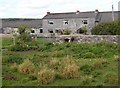


3 photos from this area
Area Information
Key information about the SA33 4RS including its size, population, and administrative classification.
- Area Type
- Postcode
- Area Size
- 17.5 km²
- Population
- 1099
- Population Density
- 43 people/km²
House Prices in SA33 4RS
10
Properties
£686,939
Average Sold Price
£70,000
Lowest Price
£1,230,816
Highest Price
Showing 10 properties
| Address | Type | Beds | Baths | Last Sale Price | Last Sale Date | |
|---|---|---|---|---|---|---|
| Malthouse Farm, U 6617 From, Laugharne, Carmarthen, SA33 4RS | Detached | 6 | 5 | £1,230,816 | Oct 2023 | |
| Longridge Farm, U 6616 From, Laugharne, Carmarthen, SA33 4RS | Farm | 4 | 1 | £760,000 | Sep 2021 | |
| Easthouse Farm, U 6617 From, Laugharne, Carmarthen, SA33 4RS | house | - | - | £70,000 | Sep 2017 | |
| West Marsh Farm, Laugharne To Pendine, Llanmiloe, Carmarthen, SA33 4RS | Land | 1 | 1 | - | - | |
| Nine Acres, U 6616 From, Laugharne, Carmarthen, SA33 4RS | Detached | - | - | - | - | |
| Bannister Farm, U 6616 From, Laugharne, Carmarthen, SA33 4RS | house | - | - | - | - | |
| The Corran Resort And Spa, U 6617 From, Laugharne, Carmarthen, SA33 4RS | hotel | - | - | - | - | |
| Brill, U 6616 From, Laugharne, Carmarthen, SA33 4RS | house | - | - | - | - | |
| Beudy Howel, U 6616 From, Laugharne, Carmarthen, SA33 4RS | Detached | - | - | - | - | |
| West House, U 6616 From, Laugharne, Carmarthen, SA33 4RS | Detached | - | - | - | - |
Energy Efficiency in SA33 4RS
Amenities
Schools
| Rank | School | Type | Entry gender | Ages |
|---|
Explore more schools in this area
Go to Schools tabDemographics
Household Size
Two person
most common
Accommodation Type
Houses
most common
Tenure
68
majority
Ethnic Group
White
most common
Religion
N/A
most common
Household Composition
N/A
most common
Age
47
median
Adults (30-64 years)
most common
Household Deprivation
N/A
with no deprivation
NS-SEC
30
in Lower managerial occupations
Explore more demographic insights in this area
Go to Demographics tabPlanning
Planning Constraints
- Flood RiskPremium
- Ramsar Wetland SitesPremium
- Area of Outstanding Natural BeautyPremium
- Protected Nature ReservePremium
- Protected WoodlandPremium
- Crime RiskPremium