Area Overview for SA33 4RR
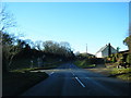
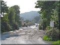
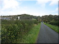
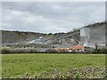
Photos of SA33 4RR
Area Information
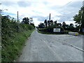
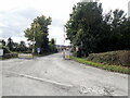
Living in SA33 4RR means residing in a compact residential cluster covering 41.3 hectares. This specific postcode area serves a population of 1,099 people, resulting in a low population density of 43 people per square kilometre. The setting offers a quiet residential environment rather than urban sprawl. Each section of SA33 4RR functions as a small neighbourhood with its own distinct character within the larger Swansea local authority context. The area is defined by its manageable size, which contributes to a close-knit atmosphere where neighbours are likely to know one another. Residents here experience daily life in an intimate setting where the scale of development keeps pace with local needs. The geographical footprint ensures that distances between homes and key local points remain short. This makes SA33 4RR suitable for those who prefer a smaller community without the isolation of completely rural locations. The area stands as a concrete example of planned residential spacing in Wales, balancing space with accessibility. You can expect a peaceful environment where the pace of life aligns with the lower density figure.
- Area Type
- Postcode
- Area Size
- 41.3 hectares
- Population
- 1099
- Population Density
- 43 people/km²
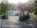
The housing stock in SA33 4RR is characterised by a strong owner-occupier presence. Sixty-eight per cent of properties are owned by their residents, meaning the market is driven by people looking to stay rather than landlords cycling tenants through the stock. Houses dominate the accommodation type distribution, so you will find single-family detached and semi-detached dwellings rather than apartment blocks. This composition makes SA33 4RR particularly attractive to families seeking private gardens and separate entrances. The concentration of owner-occupied homes usually implies a lower turnover rate compared to rental-heavy districts. When buying homes in SA33 4RR, you are often purchasing from individuals who have remained in the area for significant periods. This stability can create a tighter, more predictable market environment. The lack of rental accommodation suggests that investment by professional landlords is minimal here. Consequently, supply dependencies are less volatile than in areas dominated by multiple housing associations. Buyers looking for traditional housing in a low-density setting will find what they need within this specific postcode cluster.
House Prices in SA33 4RR
No properties found in this postcode.
Energy Efficiency in SA33 4RR
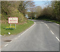
Daily life in SA33 4RR revolves around a handful of nearby amenities that sit within practical reach of residents. Shopping necessities are accessible through two local retail outlets, specifically Spar and Co-op St. These high street retailers provide essentials for food, drinks, and daily household needs without requiring a long drive to Swansea city centre. For travel, ferryside railway station stands as the closest rail connection, offering a straightforward link to wider transport networks. The combination of these two facilities creates a functional everyday lifestyle for those residing in this cluster. While there are no luxury dining options or large leisure centres listed for this specific postcode, the immediate availability of a post office branch and a superstore ensures that errands remain manageable. The character of living in SA33 4RR is defined by self-sufficiency and the ability to attend to immediate needs without travel fatigue. You will find a straightforward, no-frills approach to daily shopping and commuting that fits the low-density nature of the area.
Amenities
Schools
Families considering schools near SA33 4RR have Laugharne V.C.P. School as their primary local institution. This school is listed as an 'other' type within the local education landscape for the SA33 postcode. As with any specific educational choice, verifying the current Ofsted rating requires checking thelatest official records directly with the school or the Welsh Government database. The presence of this single listed school indicates that primary or specialisation education is located nearby. For children living in SA33 4RR, school journeys are generally short due to the low density of the area. Parents must ensure that commute times align with their specific transport needs and the child's age group. The proximity of Laugharne V.C.P. School suggests that educational infrastructure is present and accessible without needing cross-county travel.
| Rank | School | Type | Entry gender | Ages |
|---|
Explore more schools in this area
Go to Schools tabDemographics
The community in SA33 4RR reflects a maturity that is typical of established residential areas. The median age sits at 47 years, while the majority of residents fall into the 30 to 64 year range. This age profile suggests a population that has likely settled down and invested in long-term living arrangements. Home ownership is highly prevalent, with 68% of homes owned outright or with a mortgage. The remaining 32% of the population comprises renters or other non-owner-occupier statuses. Houses form the predominant accommodation type, confirming that the area lacks the high-rise flats or terraced blocks common in denser city centres. The predominant ethnic group is White, reflecting the broader demographic trends in many parts of South Wales. With a median age of 47, many households in this area consist of families with older children or elderly couples living together. The high rate of home ownership indicates financial stability among residents and a strong attachment to the locality. Living in SA33 4RR involves being part of a demographic that values stability and established community ties over transient stop-over accommodation.
Household Size
Accommodation Type
Tenure
Ethnic Group
Religion
Household Composition
Age
Household Deprivation
NS-SEC
Explore more demographic insights in this area
Go to Demographics tabPlanning
Planning Constraints
- Flood RiskPremium
- Ramsar Wetland SitesPremium
- Area of Outstanding Natural BeautyPremium
- Protected Nature ReservePremium
- Protected WoodlandPremium
- Crime RiskPremium