Area Overview for SA33 4UG
Photos of SA33 4UG


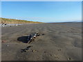

6 photos from this area
Area Information
Key information about the SA33 4UG including its size, population, and administrative classification.
- Area Type
- Postcode
- Area Size
- 1.6 km²
- Population
- 1490
- Population Density
- 20 people/km²
House Prices in SA33 4UG
34
Properties
£141,431
Average Sold Price
£41,000
Lowest Price
£280,000
Highest Price
Showing 34 properties
| Address | Type | Beds | Baths | Last Sale Price | Last Sale Date | |
|---|---|---|---|---|---|---|
| 20 Wood End, Pendine, Carmarthen, SA33 4UG | Semi-detached | 3 | 2 | £60,625 | Apr 2024 | |
| 19 Wood End, Pendine, Carmarthen, SA33 4UG | Semi-detached | 3 | 1 | £153,000 | Nov 2023 | |
| 13 Wood End, Pendine, Carmarthen, SA33 4UG | Semi-detached | 3 | 1 | £135,000 | Jun 2023 | |
| 18 Wood End, Pendine, Carmarthen, SA33 4UG | Semi-detached | 4 | 2 | £280,000 | May 2023 | |
| Fern Cottage, Wood End, Pendine, Carmarthen, SA33 4UG | Bungalow | 3 | 3 | £260,000 | Sep 2017 | |
| 24 Wood End, Pendine, Carmarthen, SA33 4UG | Semi-detached | 4 | 1 | £159,500 | Dec 2016 | |
| Jacaranda, Wood End, Pendine, Carmarthen, SA33 4UG | Bungalow | 3 | - | £178,000 | Apr 2013 | |
| The Grange, Wood End, Pendine, Carmarthen, SA33 4UG | Bungalow | 5 | - | £249,990 | Aug 2012 | |
| 21 Wood End, Pendine, Carmarthen, SA33 4UG | house | - | - | £140,000 | Nov 2011 | |
| 1 Wood End, Pendine, Carmarthen, SA33 4UG | house | 3 | 2 | £125,000 | Apr 2009 |
Page 1 of 4
Energy Efficiency in SA33 4UG
Amenities
Schools
| Rank | School | Type | Entry gender | Ages |
|---|
Explore more schools in this area
Go to Schools tabDemographics
Household Size
Two person
most common
Accommodation Type
Houses
most common
Tenure
71
majority
Ethnic Group
White
most common
Religion
N/A
most common
Household Composition
N/A
most common
Age
47
median
Adults (30-64 years)
most common
Household Deprivation
N/A
with no deprivation
NS-SEC
25
in Lower managerial occupations
Explore more demographic insights in this area
Go to Demographics tabPlanning
Planning Constraints
- Flood RiskPremium
- Ramsar Wetland SitesPremium
- Area of Outstanding Natural BeautyPremium
- Protected Nature ReservePremium
- Protected WoodlandPremium
- Crime RiskPremium