Area Overview for CF11 8YZ
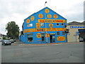
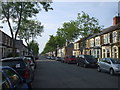
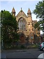
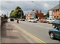
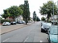
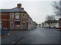
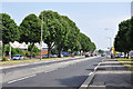
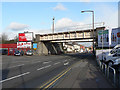
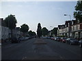
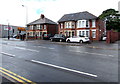
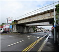
Photos of CF11 8YZ

Area Information
CF11 8YZ is a small residential cluster in Cardiff, Wales, occupying just 1.4 hectares and home to 1,591 people. Its compact size and high population density of 1,171 people per square kilometre reflect its role as a tightly knit urban suburb. Historically, the area was marshy farmland linked to Margam Abbey in the 12th century, later transformed by 19th-century infrastructure like Penarth Road and bridges connecting Cardiff to Penarth. Today, it is a mature community with a median age of 47, where many residents live in owner-occupied homes. The area’s proximity to the River Taff and its historical roots as a former civil parish give it a distinct character. With easy access to rail, retail, and ferry services, daily life here balances convenience with a sense of rootedness. The Grange, an 800-year-old building, and early streets like Holmesdale and Kent hint at its long-standing residential appeal. For buyers, CF11 8YZ offers a blend of compact living and established infrastructure, ideal for those seeking a settled lifestyle near Cardiff’s core.
- Area Type
- Postcode
- Area Size
- 1.4 hectares
- Population
- 1591
- Population Density
- 1171 people/km²
CF11 8YZ is predominantly an owner-occupied area, with 65% of homes owned by residents rather than rented. The accommodation type is primarily houses, which is unusual for a small postcode area but may reflect the historical development of the suburb. This suggests a mix of family homes and possibly larger properties, given the compact nature of the area. The limited size of CF11 8YZ means the housing stock is finite, so buyers should consider proximity to nearby areas for more options. The high home ownership rate indicates a stable market, with properties likely retaining value due to their location near transport links and amenities. However, the small area size means competition for properties could be fierce, and buyers should prioritise locations with direct access to schools, retail, and rail services.
House Prices in CF11 8YZ
Showing 1 properties
| Address | Type | Beds | Baths | Last Sale Price | Last Sale Date | |
|---|---|---|---|---|---|---|
| Caravan 7 Inner Wheel Service Station, 297 Penarth Road, Leckwith, Cardiff, CF11 8YZ | Mobile Home | - | - | - | - |
Energy Efficiency in CF11 8YZ
CF11 8YZ offers a practical lifestyle with easy access to essential amenities. The nearby retail options, including Tesco, Lidl, and Iceland, ensure daily shopping needs are met without long journeys. Rail stations such as Grangetown and Ninian Park provide direct links to Cardiff’s business districts and transport hubs. Ferry stops like Taffs Mead and Clarence Embankment offer scenic river routes and connections to nearby areas. The area’s compact size means amenities are within walking or short cycling distance, fostering a community-oriented environment. While parks or green spaces are not explicitly mentioned, the historical mention of the River Taff and nearby waterbus stops suggests proximity to natural features. This combination of retail, transport, and connectivity makes CF11 8YZ a convenient base for both daily life and commuting.
Amenities
Schools
The area is served by two primary schools: Ninian Park Primary School and Ysgol Newydd - Ninian Park Primary School. Both are listed as “other” in the data, though no Ofsted ratings are provided. The presence of two primary schools within the postcode suggests a focus on early education, which is crucial for families with young children. The proximity of these schools to residential properties reduces commuting time for parents and supports a community-oriented lifestyle. While the specific quality of education is not detailed, the availability of two schools indicates a reasonable choice for families. However, buyers should investigate further for detailed performance metrics or additional educational options nearby.
| Rank | School | Type | Entry gender | Ages |
|---|
Explore more schools in this area
Go to Schools tabDemographics
The population of CF11 8YZ is 1,591, with a median age of 47 and the majority of residents falling within the 30-64 age range. This suggests a community of middle-aged adults, many of whom may be long-term residents or families. Home ownership is strong, with 65% of properties owner-occupied, and the predominant accommodation type is houses. The White ethnic group constitutes the largest demographic, though no specific data on diversity or deprivation is provided. The high population density of 1,171 people per square kilometre indicates a compact, possibly multi-generational living environment. This profile suggests a stable, established community where residents may prioritise long-term residency over frequent moves. The absence of specific data on deprivation means the quality of life can only be inferred from the area’s amenities and infrastructure, which appear to support a functional, if not luxurious, lifestyle.
Household Size
Accommodation Type
Tenure
Ethnic Group
Religion
Household Composition
Age
Household Deprivation
NS-SEC
Explore more demographic insights in this area
Go to Demographics tabPlanning
Planning Constraints
- Flood RiskPremium
- Ramsar Wetland SitesPremium
- Area of Outstanding Natural BeautyPremium
- Protected Nature ReservePremium
- Protected WoodlandPremium
- Crime RiskPremium