Area Overview for CF11 8UL
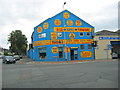
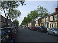
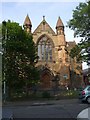
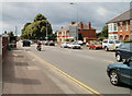
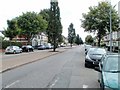
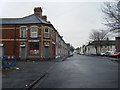
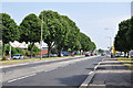
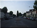
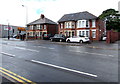
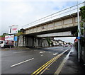
Photos of CF11 8UL


Area Information
CF11 8UL is a small residential postcode in Cardiff, Wales, encompassing a compact cluster of homes within 1.0 hectare. With a population of 1,591 and a density of 1,171 people per square kilometre, it reflects a tightly knit community. Historically, the area was marshy farmland granted to Margam Abbey in the 12th century, later transformed into housing from the 1850s onward. Today, it balances its past with modern living, offering proximity to Cardiff’s city centre and transport links. The median age of 47 suggests a mature demographic, with adults aged 30–64 forming the largest group. Home ownership sits at 65%, with houses predominating. Residents benefit from nearby schools, rail stations, and retail hubs, though flood risk remains a notable consideration. This area suits those seeking a compact, established neighbourhood with a mix of historical character and contemporary convenience.
- Area Type
- Postcode
- Area Size
- 1.0 hectares
- Population
- 1591
- Population Density
- 1171 people/km²
CF11 8UL is a small, owner-occupied area, with 65% of homes owned by residents rather than rented. The accommodation type is predominantly houses, indicating a focus on family homes and single-family living. Given the area’s size—just 1.0 hectare—the housing stock is limited, which may mean competition for properties. Buyers should consider nearby areas for broader options, though the compact nature of CF11 8UL ensures proximity to amenities and transport. The high home ownership rate suggests a stable market, with properties likely retaining value due to their rarity in such a small postcode. However, the limited size also means buyers must act swiftly, as availability is constrained.
House Prices in CF11 8UL
No properties found in this postcode.
Energy Efficiency in CF11 8UL
Residents of CF11 8UL enjoy a range of amenities within practical reach. Retail options include major supermarkets like Tesco Grangetown and Lidl Cardiff, ensuring daily shopping needs are met. Ferry stops such as Taffs Mead Waterbus Stop provide access to water-based travel, adding variety to commuting and leisure. The area’s rail network, with stations like Ninian Park Railway Station, connects to Cardiff’s broader transport system. While specific parks or leisure venues are not listed in the data, the historical presence of sites like The Grange—a centuries-old building—hints at a blend of heritage and modern convenience. The proximity to retail, transport, and waterways suggests a lifestyle that balances practicality with accessibility.
Amenities
Schools
Residents of CF11 8UL have access to two primary schools: Ninian Park Primary School and Ysgol Newydd - Ninian Park Primary School. Both are listed as “other” in type, though no Ofsted ratings are provided in the data. The presence of two primary schools within the area offers families multiple options for early education, though specific details about curriculum or facilities are not available. The schools’ proximity to homes reduces commuting time, which is particularly beneficial for working parents. The clustering of educational institutions suggests a focus on local schooling, which may appeal to families prioritising convenience over specialist provisions.
| Rank | School | Type | Entry gender | Ages |
|---|
Explore more schools in this area
Go to Schools tabDemographics
CF11 8UL’s population of 1,591 is concentrated in a 1.0-hectare area, translating to a high density of 1,171 people per square kilometre. The median age of 47 indicates a community skewed toward middle-aged adults, with 30–64-year-olds comprising the largest age group. Home ownership is strong, with 65% of residents owning their homes, and the accommodation type is predominantly houses. The predominant ethnic group is White, reflecting the area’s historical and demographic continuity. While specific data on deprivation is absent, the high home ownership and mature age profile suggest a relatively stable, established community. The compact size and density imply a close-knit social environment, where residents likely share long-term ties to the area.
Household Size
Accommodation Type
Tenure
Ethnic Group
Religion
Household Composition
Age
Household Deprivation
NS-SEC
Explore more demographic insights in this area
Go to Demographics tabPlanning
Planning Constraints
- Flood RiskPremium
- Ramsar Wetland SitesPremium
- Area of Outstanding Natural BeautyPremium
- Protected Nature ReservePremium
- Protected WoodlandPremium
- Crime RiskPremium