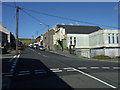
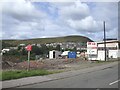
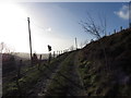
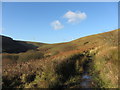
Area Overview for CF39 8RE
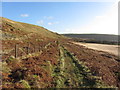
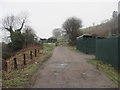
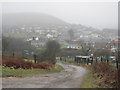
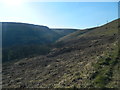
Photos of CF39 8RE


Area Information
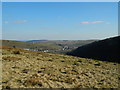
Living in CF39 8RE offers a quiet existence within a small residential cluster covering just 1.3 hectares. This specific postcode area forms part of a larger community with a total population of 1,089 residents. The location sits in Wales, characterised by a population density of 104 people per square kilometre, which suggests a low-key, non-crowded environment. While the post code itself covers a compact freehold, it feeds into the wider historic context of the Ogmore Valley. This former industrial landscape transitioned from a rural hill farming community to a populated valley during the 19th century. You will find yourself in an area that has moved past its coal mining roots without necessarily shedding its quiet character. The surrounding villages of Ogmore Vale and Nantymoel provide a backdrop of established neighbourhoods. Daily life here involves a regular pace, away from the frenetic energy of larger urban centres. You can expect a neighbourhood where houses dominate the streetscape, reflecting a long-standing preference for private homes over flats. The area blends the stability of established communities with the intimate scale of a specific postcode.
- Area Type
- Postcode
- Area Size
- 1.3 hectares
- Population
- 1089
- Population Density
- 104 people/km²
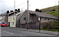
The property market in CF39 8RE is characterised by a heavy preference for owner-occupied homes. With a home ownership rate of 66%, the area is distinctly one where residents live in properties they have purchased or inherited rather than renting. The accommodation type is almost exclusively houses, meaning you will not find blocks of flats or urban-style apartments. This 1.3-hectare residential cluster is defined by standalone dwellings and detached or semi-detached structures typical of the region's valley setting. For a prospective buyer, this indicates a market where off-market listings can be harder to find, as owners often sell privately or through local networks. The high rate of ownership suggests a community value of attachment to specific properties. You are looking at a market where second-hand homes dominate the stock. This is not a transient rental zone. The housing stock reflects the historical transition from mining communities to modern family homes. While prices are not detailed in the current dataset, the nature of the property implies a focus on durability and space. When viewing homes in this postcode, you can expect traditional construction. The lack of multi-unit developments ensures that noise levels remain low and privacy is maintained. Buyers seeking a house in a quiet setting will find this location suitable. The market moves at a slower pace, reflecting the lower population density and limited supply.
House Prices in CF39 8RE
Showing 51 properties
| Address | Type | Beds | Baths | Last Sale Price | Last Sale Date | |
|---|---|---|---|---|---|---|
| 49 Coronation Road, Evanstown, Gilfach Goch, CF39 8RE | Terraced | 3 | 1 | £60,000 | Jun 2025 | |
| 6 Coronation Road, Evanstown, Gilfach Goch, CF39 8RE | house | - | - | £120,000 | Jul 2022 | |
| 50 Coronation Road, Evanstown, Gilfach Goch, CF39 8RE | house | - | - | £106,000 | Sep 2021 | |
| 41 Coronation Road, Evanstown, Gilfach Goch, CF39 8RE | Terraced | 3 | 1 | £110,000 | Mar 2021 | |
| 28 Coronation Road, Evanstown, Gilfach Goch, CF39 8RE | house | - | - | £81,000 | Mar 2020 | |
| 27 Coronation Road, Evanstown, Gilfach Goch, CF39 8RE | house | - | - | £105,000 | Sep 2019 | |
| 21 Coronation Road, Evanstown, Gilfach Goch, CF39 8RE | Terraced | 3 | 1 | £77,000 | Mar 2018 | |
| 13 Coronation Road, Evanstown, Gilfach Goch, CF39 8RE | Terraced | 2 | 1 | £78,000 | Mar 2018 | |
| 34 Coronation Road, Evanstown, Gilfach Goch, CF39 8RE | Terraced | - | - | £100,000 | Jul 2017 | |
| 29 Coronation Road, Evanstown, Gilfach Goch, CF39 8RE | Terraced | 3 | - | £69,000 | Feb 2017 |
Energy Efficiency in CF39 8RE
Your daily lifestyle in CF39 8RE revolves around accessible local amenities within practical reach. For retail needs, you are served by five nearby shops. Notably, the area has access to a Co-op Garden, Co-op Tonyrefail, and Co-op Penygraig. These supermarkets provide a wide range of groceries, household goods, and fresh produce without the need for long car journeys. If you prefer a quieter shopping experience, the smaller Co-op Garden offers essential items. Whole foods and a selection of local goods are available at these larger listings. For transport and commuting, five rail stations lie within easy access. Tonypandy Railway Station, Dinas Railway Station, and Llwynypia Railway Station form the backbone of the local public transport network. These stations connect you to wider services in Bridgend and beyond. You can travel to mountain resorts in Prestatyn or Swansea and then onwards to London. The rail links provide a reliable alternative to driving. On Sundays, you can catch a train to South Wales. The proximity of these five stations means you rarely need to drive for basic travel. This combination of local shops and regional rail access offers a balanced lifestyle. You have the convenience of a village with the connectivity of a town.
Amenities
Schools
Families considering schools near CF39 8RE have one primary option listed within the immediate data parameters. Abercerdin Primary School serves the local area and operates as a primary institution. The school is noted for its other category designation, indicating its specific setting within the local education framework. While no Ofsted rating is currently displayed for this specific entry, its presence confirms that primary education is available nearby. This school type means most children in CF39 8RE attend smaller, attached primary institutions typical of the valley. You cannot assume the availability of secondary schools or secondaries near this specific postcode based on the current information. Parents must look slightly further afield for secondary education options or rely on feeder arrangements from Abercerdin Primary. The mix is singular, though small in scale, which suggests that the school operates as a key community hub. Commuting to a larger comprehensive in a nearby town like Ogmore Vale or Nantymoel may be necessary for older students. However, the proximity of Abercerdin Primary ensures that early years education is accessible without significant travel. This setup supports a stable routine for children living in the residential cluster.
| Rank | School | Type | Entry gender | Ages |
|---|
Explore more schools in this area
Go to Schools tabDemographics
The community in CF39 8RE reflects a settled population with a median age of 47 years. Most commonly, the area is populated by adults between 30 and 64 years old, indicating a significant number of families or long-term residents rather than young singles or retirees. This age profile suggests stability and established households. The accommodation throughout this part of the wider area consists primarily of houses, which aligns with the historical development of the valley. Home ownership is a defining feature of the neighbourhood, with 66% of households owned outright or with a mortgage. This high figure reinforces the sense of permanence among residents. The ethnic composition is predominantly White, mirroring the traditional demographic patterns of many Welsh valleys. You do not typically find high deprivation statistics cited for the specific postcode, allowing for a straightforward assessment of quality of life. The low population density of roughly 104 people per square kilometre contributes to a calm atmosphere. Residents enjoy a established social fabric where neighbours often know each other. The grounds are spacious enough to support gardens and small local gatherings. This environment supports a lifestyle focused on stability and community integration.
Household Size
Accommodation Type
Tenure
Ethnic Group
Religion
Household Composition
Age
Household Deprivation
NS-SEC
Explore more demographic insights in this area
Go to Demographics tabPlanning
Planning Constraints
- Flood RiskPremium
- Ramsar Wetland SitesPremium
- Area of Outstanding Natural BeautyPremium
- Protected Nature ReservePremium
- Protected WoodlandPremium
- Crime RiskPremium