Area Overview for CF32 7SR
Photos of CF32 7SR
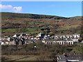


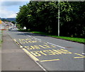
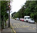

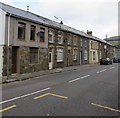
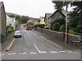


95 photos from this area
Area Information
Key information about the CF32 7SR including its size, population, and administrative classification.
- Area Type
- Postcode
- Area Size
- 3.6 hectares
- Population
- 1755
- Population Density
- 192 people/km²
House Prices in CF32 7SR
56
Properties
£70,191
Average Sold Price
£26,000
Lowest Price
£160,000
Highest Price
Showing 56 properties
| Address | Type | Beds | Baths | Last Sale Price | Last Sale Date | |
|---|---|---|---|---|---|---|
| 64 Oakfield Terrace, Price Town, Nant Y Moel, CF32 7SR | Terraced | 3 | 1 | £160,000 | Jul 2025 | |
| 52 Oakfield Terrace, Price Town, Nant Y Moel, CF32 7SR | Terraced | 3 | - | £45,000 | Jun 2025 | |
| 53 Oakfield Terrace, Price Town, Nant Y Moel, CF32 7SR | Terraced | 3 | 1 | £110,000 | Jun 2023 | |
| 93 Oakfield Terrace, Price Town, Nant Y Moel, CF32 7SR | Terraced | 3 | - | £90,000 | Dec 2021 | |
| 78 Oakfield Terrace, Price Town, Nant Y Moel, CF32 7SR | Terraced | 2 | 1 | £80,000 | Oct 2021 | |
| 61 Oakfield Terrace, Price Town, Nant Y Moel, CF32 7SR | house | - | - | £110,000 | Sep 2021 | |
| 74 Oakfield Terrace, Price Town, Nant Y Moel, CF32 7SR | house | - | - | £134,950 | Sep 2021 | |
| 69 Oakfield Terrace, Price Town, Nant Y Moel, CF32 7SR | Terraced | 3 | 1 | £70,000 | Sep 2020 | |
| 70 Oakfield Terrace, Price Town, Nant Y Moel, CF32 7SR | Terraced | 2 | 1 | £79,000 | Jun 2020 | |
| 104 Oakfield Terrace, Price Town, Nant Y Moel, CF32 7SR | Terraced | 2 | 1 | £79,000 | Apr 2020 |
Page 1 of 6
Energy Efficiency in CF32 7SR
Amenities
Schools
| Rank | School | Type | Entry gender | Ages |
|---|
Explore more schools in this area
Go to Schools tabDemographics
Household Size
Family (3-5 people)
most common
Accommodation Type
Houses
most common
Tenure
77
majority
Ethnic Group
White
most common
Religion
N/A
most common
Household Composition
N/A
most common
Age
47
median
Adults (30-64 years)
most common
Household Deprivation
N/A
with no deprivation
NS-SEC
24
in Lower managerial occupations
Explore more demographic insights in this area
Go to Demographics tabPlanning
Planning Constraints
- Flood RiskPremium
- Ramsar Wetland SitesPremium
- Area of Outstanding Natural BeautyPremium
- Protected Nature ReservePremium
- Protected WoodlandPremium
- Crime RiskPremium