Area Overview for CF31 1JQ
Photos of CF31 1JQ

Area Information
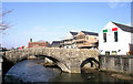
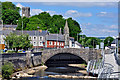
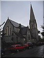
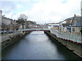
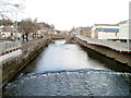
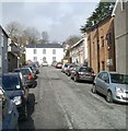
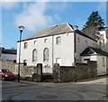
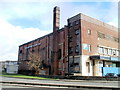
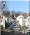
CF31 1JQ is a small, tightly packed residential postcode in Bridgend County Borough, Wales, centred on the historic River Ogmore settlement. With a population of 1,607 spread across just 141 square metres, the area is densely populated, reflecting its role as a core part of the Bridgend community. This civil parish, formed in 1974 and expanded in 1996, sits at the heart of a region with medieval roots and a legacy of trade and industry. Daily life here is shaped by proximity to Bridgend’s rail network and retail hubs, while the compact layout means residents are close to local amenities. The area’s demographics suggest a mature, stable population, with a median age of 47 and a strong presence of adults aged 30–64. Living here offers a mix of historical context and modern convenience, though the high density may influence the pace of life. For buyers, it’s a niche area with limited housing stock, requiring careful consideration of its small-scale character.
- Area Type
- Postcode
- Area Size
- 141 m²
- Population
- 1607
- Population Density
- 3741 people/km²
The property market in CF31 1JQ is defined by a 50% home ownership rate, with houses making up the majority of accommodation types. This suggests a mix of owner-occupied homes and rental properties, though the exact balance of the latter is unclear. Given the area’s small size and high population density, the housing stock is limited, meaning buyers must consider the scarcity of available properties. The predominance of houses, rather than flats or apartments, indicates a focus on family homes or larger residences, which may appeal to those seeking space in a compact setting. However, the small scale of the area means that property choices are constrained, and buyers should be prepared to look beyond immediate surroundings for more options. The market likely reflects a blend of long-term residents and those seeking proximity to Bridgend’s amenities, with prices potentially influenced by the area’s historical and geographical significance.
House Prices in CF31 1JQ
No properties found in this postcode.
Energy Efficiency in CF31 1JQ
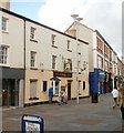
The lifestyle in CF31 1JQ is shaped by its proximity to retail and rail amenities. Within practical reach are five retail outlets, including Spar, Tesco Bridgend, and Iceland Bridgend, providing everyday shopping convenience. These stores cater to both daily needs and larger purchases, reducing the need for longer trips. The rail network, with stations like Bridgend and Sarn, adds to the area’s accessibility, enabling easy travel for work, leisure, or socialising. While the data does not mention parks or leisure facilities directly, the historical context of Bridgend as a market town suggests a blend of urban and semi-rural character. The compact layout ensures residents can access essentials quickly, though the lack of specific details on green spaces or recreational areas means further exploration is advisable for those prioritising outdoor activities.
Amenities
Schools
The nearest school to CF31 1JQ is Penybont Primary School, categorised as an “other” type in the data. No specific Ofsted rating is provided, so its educational quality remains unquantified. As a primary school, it serves the local community’s younger residents, though the absence of secondary schools or additional educational institutions in the immediate vicinity may require families to travel further for secondary education. The single listed school suggests a limited range of educational options, which could be a consideration for families prioritising a variety of school types. Without further data on performance or capacity, prospective residents should investigate independently to assess whether Penybont Primary meets their needs.
| Rank | School | Type | Entry gender | Ages |
|---|
Explore more schools in this area
Go to Schools tabDemographics
The community in CF31 1JQ has a median age of 47, with the most common age range being adults aged 30–64. This suggests a population skewed towards middle-aged residents, many of whom may be established in their careers or retired. Home ownership stands at 50%, with houses being the predominant accommodation type. This indicates a mix of owner-occupied properties and rental units, though the exact proportion of rentals is not specified. The predominant ethnic group is White, reflecting broader trends in the region. The high population density of 11,380,656 people per square kilometre is striking, implying a tightly packed residential environment. While this density may support a strong local community, it could also contribute to challenges in space and infrastructure. The data does not provide direct measures of deprivation, but the demographic profile suggests a relatively stable, middle-aged population with established ties to the area.
Household Size
Accommodation Type
Tenure
Ethnic Group
Religion
Household Composition
Age
Household Deprivation
NS-SEC
Explore more demographic insights in this area
Go to Demographics tabPlanning
Planning Constraints
- Flood RiskPremium
- Ramsar Wetland SitesPremium
- Area of Outstanding Natural BeautyPremium
- Protected Nature ReservePremium
- Protected WoodlandPremium
- Crime RiskPremium