Area Overview for CF31 1HG
Photos of CF31 1HG
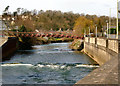
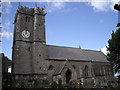
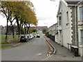
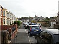
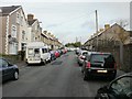
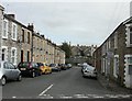
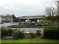
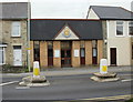
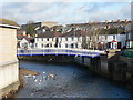
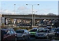
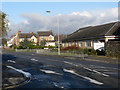
100 photos from this area
Area Information
Key information about the CF31 1HG including its size, population, and administrative classification.
- Area Type
- Postcode
- Area Size
- 8263 m²
- Population
- 1607
- Population Density
- 3741 people/km²
House Prices in CF31 1HG
34
Properties
£91,941
Average Sold Price
£32,000
Lowest Price
£165,000
Highest Price
Showing 34 properties
| Address | Type | Beds | Baths | Last Sale Price | Last Sale Date | |
|---|---|---|---|---|---|---|
| 14 Brook Street, Bridgend, CF31 1HG | Terraced | 3 | 1 | £160,000 | Oct 2022 | |
| 23 Brook Street, Bridgend, CF31 1HG | Terraced | 2 | 6 | £156,000 | Oct 2022 | |
| 13 Brook Street, Bridgend, CF31 1HG | house | - | - | £132,000 | Aug 2022 | |
| 22 Brook Street, Bridgend, CF31 1HG | Terraced | 2 | 1 | £130,000 | May 2021 | |
| 8 Brook Street, Bridgend, CF31 1HG | house | - | - | £105,000 | Aug 2019 | |
| 10 Brook Street, Bridgend, CF31 1HG | Terraced | 3 | 1 | £122,000 | May 2018 | |
| 26 Brook Street, Bridgend, CF31 1HG | Terraced | 3 | 1 | £95,000 | May 2017 | |
| 27 Brook Street, Bridgend, CF31 1HG | Terraced | 2 | 1 | £106,000 | May 2017 | |
| 25 Brook Street, Bridgend, CF31 1HG | house | - | - | £102,000 | Sep 2016 | |
| 7 Brook Street, Bridgend, CF31 1HG | house | - | - | £100,000 | May 2016 |
Page 1 of 4
Energy Efficiency in CF31 1HG
Amenities
Schools
| Rank | School | Type | Entry gender | Ages |
|---|
Explore more schools in this area
Go to Schools tabDemographics
Household Size
One person
most common
Accommodation Type
Houses
most common
Tenure
50
majority
Ethnic Group
White
most common
Religion
N/A
most common
Household Composition
N/A
most common
Age
47
median
Adults (30-64 years)
most common
Household Deprivation
N/A
with no deprivation
NS-SEC
25
in Lower managerial occupations
Explore more demographic insights in this area
Go to Demographics tabPlanning
Planning Constraints
- Flood RiskPremium
- Ramsar Wetland SitesPremium
- Area of Outstanding Natural BeautyPremium
- Protected Nature ReservePremium
- Protected WoodlandPremium
- Crime RiskPremium