Area Overview for BD7 4AA
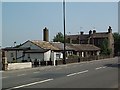
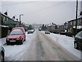
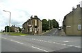
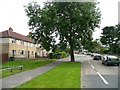
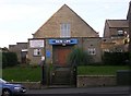
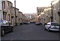
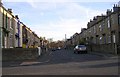
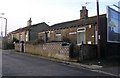
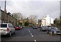
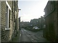
Photos of BD7 4AA


Area Information
Living in BD7 4AA means inhabiting a compact residential cluster within the historic ward of Great Horton, part of Bradford’s urban sprawl. The area spans 4,732 square metres, housing 1,798 people in a densely populated setting, with a population density of 379,943 people per square kilometre. This small postcode area is nestled approximately 2.5 miles south-west of Bradford city centre, within a conservation area that preserves 17th- to 19th-century buildings, including listed structures like Hall’s House and the Old Bell Chapel. Historically a rural settlement, it evolved into an industrial hub in the 18th and 19th centuries, marked by cotton mills and workers’ housing. Today, it blends urban convenience with preserved heritage, offering proximity to Bradford’s amenities while retaining a distinct character shaped by its Saxon-era roots and 19th-century expansion. Residents benefit from nearby public spaces like Horton Park, opened in 1878, and a network of rail links, though the area’s compact size means every resident is within walking distance of its core amenities.
- Area Type
- Postcode
- Area Size
- 4732 m²
- Population
- 1798
- Population Density
- 6300 people/km²
The property market in BD7 4AA is characterised by a 40% home ownership rate, indicating that a majority of properties are likely rented out, either by private landlords or local authorities. The accommodation type is predominantly houses, which contrasts with areas dominated by flats or apartments. This suggests a residential stock that prioritises family homes, though the small area size (4,732 m²) and high population density imply limited scope for new developments. Buyers should consider that the area’s compact nature may restrict property choices, with most homes concentrated within the conservation area’s historic boundaries. The mix of owner-occupied and rental properties could appeal to first-time buyers seeking affordability, though competition for available homes may be fierce due to the area’s desirability for its heritage and transport links.
House Prices in BD7 4AA
Showing 21 properties
| Address | Type | Beds | Baths | Last Sale Price | Last Sale Date | |
|---|---|---|---|---|---|---|
| 634 Great Horton Road, Bradford, BD7 4AA | house | 3 | 1 | £58,000 | Oct 2023 | |
| 636 Great Horton Road, Bradford, BD7 4AA | Terraced | 4 | 1 | £110,000 | Dec 2017 | |
| Brooksbank House, 670 Great Horton Road, Bradford, BD7 4AA | Detached | - | - | £85,000 | Jul 2001 | |
| 638 Great Horton Road, Bradford, BD7 4AA | Terraced | - | - | £5,000 | Jul 1997 | |
| Former 670A, Great Horton Road, Bradford, BD7 4AA | undefined | - | - | - | - | |
| 2, Brooksbank House, Saint Street, Bradford, BD7 4AA | Flat | - | - | - | - | |
| 8, Brooksbank House, Saint Street, Bradford, BD7 4AA | Flat | - | - | - | - | |
| 7, Brooksbank House, Saint Street, Bradford, BD7 4AA | Flat | - | - | - | - | |
| 6, Brooksbank House, Saint Street, Bradford, BD7 4AA | Flat | - | - | - | - | |
| 3, Brooksbank House, Saint Street, Bradford, BD7 4AA | Flat | - | - | - | - |
Energy Efficiency in BD7 4AA
Residents of BD7 4AA enjoy a range of amenities within easy reach, including retail options such as Tesco Bradford, Aldi Clayton, and Heron Clayton, which cater to daily shopping needs. The area’s proximity to Horton Park, a public space opened in 1878, provides recreational opportunities and green space for relaxation. While the data does not specify dining or leisure venues, the presence of multiple rail stations and nearby schools suggests a well-served community. The compact nature of the area means amenities are concentrated, reducing travel time for essentials. However, the lack of detailed information on dining or cultural facilities may require further local research. Overall, the blend of retail, transport, and green space supports a convenient, if tightly packed, lifestyle.
Amenities
Schools
Residents of BD7 4AA have access to a range of primary schools, including Brackenhill Primary School and St Oswald’s CofE Primary School, both rated ‘good’ by Ofsted. Great Horton Middle School and St Oswald’s Church of England Primary Academy are also nearby, though the latter holds a ‘satisfactory’ rating. The area is further served by Ummid Independent School, a special needs institution. This mix of school types ensures families have options for both mainstream and specialist education. The presence of multiple primary schools within walking distance supports a community-oriented approach to schooling, reducing reliance on transport for younger children. However, the absence of secondary schools in the immediate vicinity may require families to consider commuting for older students, a factor to weigh when evaluating the area’s suitability for long-term residency.
| Rank | School | Type | Entry gender | Ages |
|---|
Explore more schools in this area
Go to Schools tabDemographics
The community in BD7 4AA is predominantly composed of adults aged 30–64, with a median age of 47. Home ownership here is relatively low at 40%, suggesting a higher proportion of renters compared to owner-occupied properties. The accommodation type is primarily houses, reflecting a residential character distinct from high-density housing. The predominant ethnic group is Asian, though specific subgroups are not detailed in the data. The high population density—379,943 people per square kilometre—suggests a compact, closely knit community, which may influence local services and social dynamics. With no specific deprivation data provided, the area’s quality of life is likely shaped by its proximity to schools, transport, and green spaces, balanced against the challenges of high density and limited space for expansion.
Household Size
Accommodation Type
Tenure
Ethnic Group
Religion
Household Composition
Age
Household Deprivation
NS-SEC
Explore more demographic insights in this area
Go to Demographics tabPlanning
Planning Constraints
- Flood RiskPremium
- Ramsar Wetland SitesPremium
- Area of Outstanding Natural BeautyPremium
- Protected Nature ReservePremium
- Protected WoodlandPremium