Area Overview for BD7 4EL
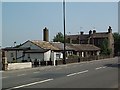
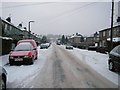
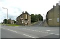
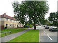
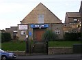
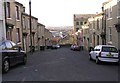
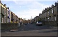
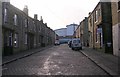
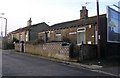
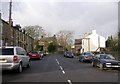
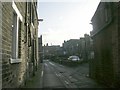
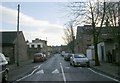
Photos of BD7 4EL
Area Information
BD7 4EL is a small, densely populated residential cluster in the City of Bradford, West Yorkshire, covering just 3,127 square metres. With 1,798 residents packed into this compact area, it reflects the urban density typical of Bradford’s historic expansion. The postcode lies within Great Horton, a conservation area that preserves 17th-19th century buildings amid modern development. This area is defined by its proximity to Bradford’s city centre, just 2.5 miles away, and its mix of historic architecture, including listed buildings like Hall’s House and Horton Park, a public park opened in 1878. Daily life here is shaped by its compact size, with residents navigating a tight-knit community surrounded by industrial heritage and recent urban growth. The area’s character stems from its origins as a rural settlement that transformed into a hub of 19th-century mills and workers’ housing, now layered with modern retail and transport links. Living in BD7 4EL means balancing historic charm with the practicalities of a high-density, urban environment.
- Area Type
- Postcode
- Area Size
- 3127 m²
- Population
- 1798
- Population Density
- 6300 people/km²
The property market in BD7 4EL is characterised by a 40% home ownership rate, with houses being the primary accommodation type. This suggests a mix of owner-occupied homes and rental properties, though the small area size means housing stock is limited. Given the high population density, properties are likely compact, reflecting the area’s historic workers’ housing roots. For buyers, this small postcode area offers limited scope for expansion, with immediate surroundings likely to mirror similar housing patterns. The dominance of houses over flats may appeal to those seeking traditional living arrangements, though the high population density could mean proximity to neighbours. Potential buyers should consider the rental market’s influence, as lower home ownership rates may indicate higher turnover or affordability challenges.
House Prices in BD7 4EL
Showing 8 properties
| Address | Type | Beds | Baths | Last Sale Price | Last Sale Date | |
|---|---|---|---|---|---|---|
| 6 Ramsden Court, Bradford, BD7 4EL | house | 2 | 1 | £43,500 | Apr 2019 | |
| 1 Ramsden Court, Bradford, BD7 4EL | house | - | - | £65,000 | Jan 2017 | |
| 2 Ramsden Court, Bradford, BD7 4EL | Semi-detached | 2 | - | £57,500 | Mar 2003 | |
| 12A Ramsden Court, Bradford, BD7 4EL | Terraced | 2 | 1 | - | - | |
| 10 Ramsden Court, Bradford, BD7 4EL | Terraced | - | - | - | - | |
| 4 Ramsden Court, Bradford, BD7 4EL | house | - | - | - | - | |
| 8 Ramsden Court, Bradford, BD7 4EL | Terraced | - | - | - | - | |
| 11 Ramsden Court, Bradford, BD7 4EL | Terraced | 2 | 1 | - | - |
Energy Efficiency in BD7 4EL
Residents of BD7 4EL have access to essential amenities within practical reach. Retail options include Tesco Bradford, Aldi Clayton, and Heron Clayton, offering everyday shopping needs. The area’s rail network, with five nearby stations, provides easy access to Bradford’s transport hubs and beyond. Horton Park, a historic public park opened in 1878, offers green space for leisure and exercise. The compact size of the postcode means amenities are concentrated, reducing travel times for essentials. This mix of retail, transport, and open space supports a convenient lifestyle, though the high population density may mean limited private outdoor space. The area’s character is defined by its blend of historic sites and modern convenience, catering to both practical and recreational needs.
Amenities
Schools
Residents of BD7 4EL have access to several primary schools, including Brackenhill Primary School, which holds a ‘good’ Ofsted rating, and St Oswald’s CofE Primary School, which has a ‘satisfactory’ rating. Great Horton Middle School and St Oswald’s Church of England Primary Academy also serve the area, offering a range of educational options. Ummid Independent School, a special needs school, adds diversity to the local education landscape. The mix of state and special schools caters to varying needs, though the ‘satisfactory’ rating at St Oswald’s suggests potential for improvement. Families seeking high-quality primary education may prioritise Brackenhill, while those requiring specialist support can rely on Ummid. The concentration of schools within close proximity reflects the area’s focus on family-friendly infrastructure.
| Rank | School | Type | Entry gender | Ages |
|---|
Explore more schools in this area
Go to Schools tabDemographics
The population of BD7 4EL is predominantly adults aged 30-64, with a median age of 47. Only 40% of residents own their homes, suggesting a rental market dominates here. The accommodation type is primarily houses, though the high population density of 575,072 people per square kilometre indicates limited space for larger properties. The predominant ethnic group is Asian, reflecting broader demographic trends in Bradford. This age profile suggests a community of established professionals and families, though the low home ownership rate may indicate economic pressures or a transient population. The absence of specific deprivation data means quality of life is inferred from infrastructure: broadband scores are excellent, but crime rates are above average. These factors shape daily life, balancing access to services with safety concerns.
Household Size
Accommodation Type
Tenure
Ethnic Group
Religion
Household Composition
Age
Household Deprivation
NS-SEC
Explore more demographic insights in this area
Go to Demographics tabPlanning
Planning Constraints
- Flood RiskPremium
- Ramsar Wetland SitesPremium
- Area of Outstanding Natural BeautyPremium
- Protected Nature ReservePremium
- Protected WoodlandPremium