Area Overview for BD7 4EJ
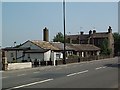
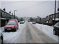
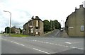
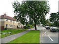
Photos of BD7 4EJ
Area Information
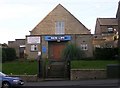
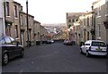
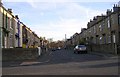
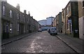
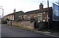
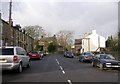
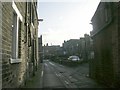
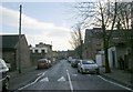
Living in BD7 4EJ means being part of a tightly knit urban residential cluster in the City of Bradford, West Yorkshire. This small postcode area, covering just 4.4 hectares, is home to 1,798 people, making it one of the most densely populated places in England, with 40,820 people per square kilometre. Situated approximately 2.5 miles south-west of Bradford city centre, BD7 4EJ lies within the historic Great Horton Conservation Area, a designated zone preserving 17th- to 19th-century buildings amid modern urban development. The area’s character is shaped by its industrial heritage, including former cotton mills and workers’ housing from the 18th and 19th centuries. Today, it blends historic architecture with contemporary living, offering proximity to Bradford’s cultural and economic hubs while retaining a distinct local identity. Residents benefit from easy access to rail networks and nearby amenities, though the area’s compact size means it is best suited for those prioritising convenience over expansive space. Its location within a conservation area ensures a mix of architectural history and modern infrastructure, appealing to those seeking a balance between heritage and practicality.
- Area Type
- Postcode
- Area Size
- 4.4 hectares
- Population
- 1798
- Population Density
- 6300 people/km²
The property market in BD7 4EJ is characterised by a 40% home ownership rate, with houses being the predominant accommodation type. This suggests a mix of owner-occupied and rental properties, though the relatively low ownership rate indicates that a significant proportion of residents are likely to be renters. Given the area’s small size and high population density, the housing stock is limited, with properties likely concentrated in older, historic homes from the 17th to 19th centuries. The presence of houses rather than flats or apartments implies a focus on family-sized dwellings, which may appeal to those seeking more space in a compact area. However, the limited land area means that new developments are constrained, and the market is likely to be competitive for buyers. For those considering purchase, the area’s conservation status may add value through its historic character, though buyers should be mindful of the challenges posed by high population density and the need for shared amenities. The market is best suited to those prioritising proximity to Bradford’s city centre and rail networks over expansive property options.
House Prices in BD7 4EJ
Showing 17 properties
| Address | Type | Beds | Baths | Last Sale Price | Last Sale Date | |
|---|---|---|---|---|---|---|
| 704 Great Horton Road, Bradford, BD7 4EJ | house | - | - | £44,000 | Sep 2023 | |
| 706 Great Horton Road, Bradford, BD7 4EJ | Terraced | 2 | 1 | £76,500 | Dec 2022 | |
| 702 Great Horton Road, Bradford, BD7 4EJ | Cottage | 2 | 1 | £50,000 | Aug 2016 | |
| Former Flat At, 682 Great Horton Road, Bradford, BD7 4EJ | Flat | 1 | 1 | £30,000 | Sep 2006 | |
| 672A Great Horton Road, Bradford, BD7 4EJ | Flat | - | - | £15,000 | Jan 2002 | |
| 684 Great Horton Road, Bradford, BD7 4EJ | Terraced | - | - | £25,000 | Feb 2001 | |
| Former Flat B, 678 Great Horton Road, Bradford, BD7 4EJ | Flat | - | - | - | - | |
| Former Flat A, 678 Great Horton Road, Bradford, BD7 4EJ | Flat | - | - | - | - | |
| Tesco, Petrol Filling Station, 700 Great Horton Road, Bradford, BD7 4EJ | Retail | - | - | - | - | |
| First Floor, Former 676, Great Horton Road, Bradford, BD7 4EJ | undefined | - | - | - | - |
Energy Efficiency in BD7 4EJ
Life in BD7 4EJ is supported by a range of nearby amenities within practical reach. Retail options include major stores such as Tesco Bradford, Aldi Clayton, and Heron Clayton, ensuring access to everyday shopping needs. The area’s rail connectivity, with stations like Bradford Interchange, facilitates travel to broader retail and leisure destinations. While specific details on dining or leisure facilities are not provided, the proximity to Bradford’s city centre suggests access to a wider array of restaurants, cafes, and cultural attractions. The historic Great Horton Conservation Area adds to the area’s character, with preserved 17th- to 19th-century buildings and Horton Park, a public space opened in 1878. This blend of heritage and practical amenities creates a convenient, compact lifestyle, ideal for those who prioritise proximity to services and a sense of community over expansive living spaces. The area’s small size means that daily errands and social activities can be managed without long commutes, enhancing the overall quality of life for residents.
Amenities
Schools
Residents of BD7 4EJ have access to a range of primary schools, including Brackenhill Primary School, which holds a good Ofsted rating, and St Oswald’s CofE Primary School, which has a satisfactory rating. Great Horton Middle School and St Oswald’s Church of England Primary Academy are also nearby, though the latter’s Ofsted rating is listed as satisfactory. The presence of Ummid Independent School, a special needs institution, adds diversity to the educational landscape. The mix of school types provides families with options, from state-funded primary education to specialist provision for students with specific needs. However, the absence of secondary schools in the immediate area means that students may need to travel to nearby districts for further education. The varying Ofsted ratings highlight the importance of visiting schools in person to assess quality, as performance can differ significantly between institutions. For families prioritising high-quality primary education, Brackenhill Primary School’s good rating may be a key consideration.
| Rank | School | Type | Entry gender | Ages |
|---|
Explore more schools in this area
Go to Schools tabDemographics
BD7 4EJ has a median age of 47, with the majority of residents aged 30–64. This suggests a mature, established community with a strong presence of working-age adults. Home ownership rates stand at 40%, indicating that a significant portion of the population rents rather than owns property. The predominant accommodation type is houses, which is uncommon in densely populated urban areas, suggesting a mix of detached and semi-detached homes. The area’s predominant ethnic group is identified as Asian_total, reflecting a culturally diverse demographic. While specific data on deprivation is absent, the high population density and mix of housing types imply a community where shared resources and communal spaces are central to daily life. The age profile and ownership statistics suggest a stable, long-term resident base, though the 40% rental rate highlights a reliance on private landlords or social housing. This demographic structure influences local services and amenities, which are tailored to meet the needs of an older, working-age population with established ties to the area.
Household Size
Accommodation Type
Tenure
Ethnic Group
Religion
Household Composition
Age
Household Deprivation
NS-SEC
Explore more demographic insights in this area
Go to Demographics tabPlanning
Planning Constraints
- Flood RiskPremium
- Ramsar Wetland SitesPremium
- Area of Outstanding Natural BeautyPremium
- Protected Nature ReservePremium
- Protected WoodlandPremium