Area Overview for WS15 2HP
Photos of WS15 2HP
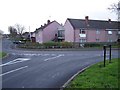
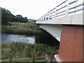
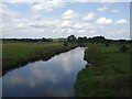
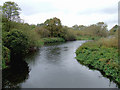
62 photos from this area
Area Information
Key information about the WS15 2HP including its size, population, and administrative classification.
- Area Type
- Postcode
- Area Size
- 8.4 hectares
- Population
- 1975
- Population Density
- 69 people/km²
House Prices in WS15 2HP
70
Properties
£176,554
Average Sold Price
£46,000
Lowest Price
£425,000
Highest Price
Showing 70 properties
| Address | Type | Beds | Baths | Last Sale Price | Last Sale Date | |
|---|---|---|---|---|---|---|
| 41 Albany Drive, Rugeley, WS15 2HP | Detached | 3 | 1 | £320,000 | Oct 2025 | |
| 22 Albany Drive, Rugeley, WS15 2HP | Detached | 3 | 1 | £232,000 | Jul 2025 | |
| 49 Albany Drive, Rugeley, WS15 2HP | house | 3 | 1 | £240,000 | Apr 2025 | |
| 51 Albany Drive, Rugeley, WS15 2HP | Detached | 4 | 1 | £259,000 | Feb 2025 | |
| 46 Albany Drive, Rugeley, WS15 2HP | Semi-detached | 2 | 1 | £210,000 | Nov 2024 | |
| 82 Albany Drive, Rugeley, WS15 2HP | Semi-detached | 2 | 1 | £186,000 | Oct 2024 | |
| 7 Albany Drive, Rugeley, WS15 2HP | Semi-detached | 2 | 1 | £161,225 | Aug 2024 | |
| 11 Albany Drive, Rugeley, WS15 2HP | Semi-detached | 2 | 1 | £172,500 | May 2024 | |
| 21 Albany Drive, Rugeley, WS15 2HP | Detached | 3 | 1 | £279,900 | Apr 2024 | |
| 84 Albany Drive, Rugeley, WS15 2HP | house | - | - | £140,000 | Apr 2024 |
Page 1 of 7
Energy Efficiency in WS15 2HP
Amenities
Schools
| Rank | School | Type | Entry gender | Ages |
|---|
Explore more schools in this area
Go to Schools tabDemographics
Household Size
Two person
most common
Accommodation Type
Houses
most common
Tenure
81
majority
Ethnic Group
White
most common
Religion
N/A
most common
Household Composition
N/A
most common
Age
47
median
Adults (30-64 years)
most common
Household Deprivation
N/A
with no deprivation
NS-SEC
41
in Lower managerial occupations
Explore more demographic insights in this area
Go to Demographics tabPlanning
Planning Constraints
- Flood RiskPremium
- Ramsar Wetland SitesPremium
- Area of Outstanding Natural BeautyPremium
- Protected Nature ReservePremium
- Protected WoodlandPremium