Area Overview for WR11 7RX
Photos of WR11 7RX
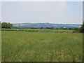
![Willersey Road [1] in WR11 7RX](https://images.propbar.co.uk/images/geograph/41/39/4139130_120.jpg)
13 photos from this area
Area Information
Key information about the WR11 7RX including its size, population, and administrative classification.
- Area Type
- Postcode
- Area Size
- 21.4 hectares
- Population
- 1477
- Population Density
- 116 people/km²
House Prices in WR11 7RX
33
Properties
£179,117
Average Sold Price
£52,000
Lowest Price
£405,000
Highest Price
Showing 33 properties
| Address | Type | Beds | Baths | Last Sale Price | Last Sale Date | |
|---|---|---|---|---|---|---|
| 1 Sally Close, Wickhamford, WR11 7RX | house | - | - | £280,000 | Nov 2024 | |
| 12 Sally Close, Wickhamford, WR11 7RX | Bungalow | - | - | £295,000 | Mar 2024 | |
| 25 Sally Close, Wickhamford, WR11 7RX | Bungalow | 3 | 2 | £405,000 | Dec 2023 | |
| 14A Sally Close, Wickhamford, WR11 7RX | Bungalow | 2 | 1 | £275,000 | Jun 2023 | |
| 30 Sally Close, Wickhamford, WR11 7RX | house | - | - | £285,000 | Jun 2021 | |
| 10 Sally Close, Wickhamford, WR11 7RX | Bungalow | - | - | £230,000 | May 2021 | |
| 5 Sally Close, Wickhamford, WR11 7RX | house | 3 | 1 | £220,000 | Apr 2019 | |
| 7 Sally Close, Wickhamford, WR11 7RX | Bungalow | - | - | £196,500 | Feb 2018 | |
| 8 Sally Close, Wickhamford, WR11 7RX | Bungalow | 2 | 1 | £230,000 | Dec 2017 | |
| 20 Sally Close, Wickhamford, WR11 7RX | Bungalow | 2 | - | £158,000 | Apr 2012 |
Page 1 of 4
Energy Efficiency in WR11 7RX
Amenities
Schools
| Rank | School | Type | Entry gender | Ages |
|---|
Explore more schools in this area
Go to Schools tabDemographics
Household Size
Two person
most common
Accommodation Type
Houses
most common
Tenure
78
majority
Ethnic Group
White
most common
Religion
N/A
most common
Household Composition
N/A
most common
Age
47
median
Adults (30-64 years)
most common
Household Deprivation
N/A
with no deprivation
NS-SEC
36
in Lower managerial occupations
Explore more demographic insights in this area
Go to Demographics tabPlanning
Planning Constraints
- Flood RiskPremium
- Ramsar Wetland SitesPremium
- Area of Outstanding Natural BeautyPremium
- Protected Nature ReservePremium
- Protected WoodlandPremium