Area Overview for WR11 7RU
Photos of WR11 7RU
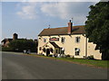
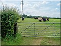
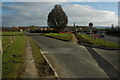
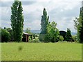
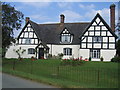
33 photos from this area
Area Information
Key information about the WR11 7RU including its size, population, and administrative classification.
- Area Type
- Postcode
- Area Size
- 1.1 hectares
- Population
- 1477
- Population Density
- 116 people/km²
House Prices in WR11 7RU
25
Properties
£162,313
Average Sold Price
£120,000
Lowest Price
£190,000
Highest Price
Showing 25 properties
| Address | Type | Beds | Baths | Last Sale Price | Last Sale Date | |
|---|---|---|---|---|---|---|
| 7 Coombefield Road, Wickhamford, WR11 7RU | Maisonette | 2 | 1 | £190,000 | Aug 2023 | |
| 6 Coombefield Road, Wickhamford, WR11 7RU | Maisonette | - | - | £169,000 | Aug 2022 | |
| 9 Coombefield Road, Wickhamford, WR11 7RU | Maisonette | 2 | - | £135,000 | Feb 2021 | |
| 16 Coombefield Road, Wickhamford, WR11 7RU | Terraced | 2 | 1 | £170,000 | Mar 2020 | |
| 11 Coombefield Road, Wickhamford, WR11 7RU | Maisonette | 2 | 1 | £137,000 | Dec 2019 | |
| 15 Coombefield Road, Wickhamford, WR11 7RU | Terraced | 3 | 2 | £120,000 | Jun 2019 | |
| 13 Coombefield Road, Wickhamford, WR11 7RU | Terraced | - | - | £190,000 | Apr 2007 | |
| 1 Coombefield Road, Wickhamford, WR11 7RU | Terraced | - | - | £187,500 | May 2006 | |
| 4 Coombefield Road, Wickhamford, WR11 7RU | Terraced | 3 | 1 | - | - | |
| 3 Coombefield Road, Wickhamford, WR11 7RU | house | 3 | - | - | - |
Page 1 of 3
Energy Efficiency in WR11 7RU
Amenities
Schools
| Rank | School | Type | Entry gender | Ages |
|---|
Explore more schools in this area
Go to Schools tabDemographics
Household Size
Two person
most common
Accommodation Type
Houses
most common
Tenure
78
majority
Ethnic Group
White
most common
Religion
N/A
most common
Household Composition
N/A
most common
Age
47
median
Adults (30-64 years)
most common
Household Deprivation
N/A
with no deprivation
NS-SEC
36
in Lower managerial occupations
Explore more demographic insights in this area
Go to Demographics tabPlanning
Planning Constraints
- Flood RiskPremium
- Ramsar Wetland SitesPremium
- Area of Outstanding Natural BeautyPremium
- Protected Nature ReservePremium
- Protected WoodlandPremium