Area Overview for WR11 7HE
Photos of WR11 7HE
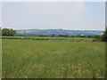
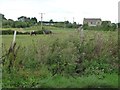
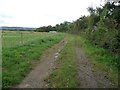
![Willersey Road [1] in WR11 7HE](https://images.propbar.co.uk/images/geograph/41/39/4139130_120.jpg)
13 photos from this area
Area Information
Key information about the WR11 7HE including its size, population, and administrative classification.
- Area Type
- Postcode
- Area Size
- 33.9 hectares
- Population
- 1386
- Population Density
- 292 people/km²
House Prices in WR11 7HE
6
Properties
£506,978
Average Sold Price
£387,500
Lowest Price
£633,000
Highest Price
Showing 6 properties
| Address | Type | Beds | Baths | Last Sale Price | Last Sale Date | |
|---|---|---|---|---|---|---|
| Rowan House, Willersey Road, Badsey, WR11 7HE | Detached | 3 | 2 | £500,433 | Aug 2025 | |
| Goosecroft, Willersey Road, Badsey, WR11 7HE | house | 2 | 1 | £387,500 | Oct 2020 | |
| Marlborough House, Willersey Road, Badsey, WR11 7HE | Bungalow | - | - | £633,000 | Nov 2010 | |
| Rowan House Boarding Kennels At, Rowan House, Willersey Road, Badsey, WR11 7HE | commercial | - | - | - | - | |
| Grooming Parlour At Rowan House Boarding Kennels At, Rowan House, Willersey Road, Badsey, WR11 7HE | commercial | - | - | - | - | |
| Windy Nook, Willersey Road, Badsey, WR11 7HE | Semi-detached | - | - | - | - |
Energy Efficiency in WR11 7HE
Amenities
Schools
| Rank | School | Type | Entry gender | Ages |
|---|
Explore more schools in this area
Go to Schools tabDemographics
Household Size
Two person
most common
Accommodation Type
Houses
most common
Tenure
89
majority
Ethnic Group
White
most common
Religion
N/A
most common
Household Composition
N/A
most common
Age
47
median
Adults (30-64 years)
most common
Household Deprivation
N/A
with no deprivation
NS-SEC
37
in Lower managerial occupations
Explore more demographic insights in this area
Go to Demographics tabPlanning
Planning Constraints
- Flood RiskPremium
- Ramsar Wetland SitesPremium
- Area of Outstanding Natural BeautyPremium
- Protected Nature ReservePremium
- Protected WoodlandPremium