Area Overview for WR11 4TJ
Photos of WR11 4TJ
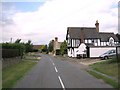
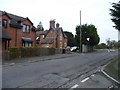

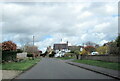


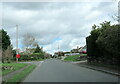
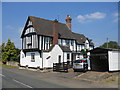
11 photos from this area
Area Information
Key information about the WR11 4TJ including its size, population, and administrative classification.
- Area Type
- Postcode
- Area Size
- 1.9 hectares
- Population
- 1393
- Population Density
- 114 people/km²
House Prices in WR11 4TJ
28
Properties
£202,617
Average Sold Price
£80,000
Lowest Price
£370,000
Highest Price
Showing 28 properties
| Address | Type | Beds | Baths | Last Sale Price | Last Sale Date | |
|---|---|---|---|---|---|---|
| 7 Kings Lane, Norton, WR11 4TJ | house | - | - | £255,000 | Nov 2022 | |
| 15 Kings Lane, Norton, WR11 4TJ | house | - | - | £370,000 | May 2022 | |
| 20 Kings Lane, Norton, WR11 4TJ | house | - | - | £270,000 | Mar 2022 | |
| 10 Kings Lane, Norton, WR11 4TJ | house | 4 | - | £350,000 | Jul 2021 | |
| 5 Kings Lane, Norton, WR11 4TJ | house | - | - | £295,000 | Jul 2021 | |
| 16 Kings Lane, Norton, WR11 4TJ | house | - | - | £200,000 | Mar 2019 | |
| 4 Kings Lane, Norton, WR11 4TJ | Semi-detached | 2 | - | £119,000 | Jan 2013 | |
| 2 Kings Lane, Norton, WR11 4TJ | house | 2 | - | £137,500 | Jun 2010 | |
| 18 Kings Lane, Norton, WR11 4TJ | Terraced | - | - | £163,500 | Nov 2007 | |
| 17 Kings Lane, Norton, WR11 4TJ | Terraced | - | - | £140,000 | Oct 2007 |
Page 1 of 3
Energy Efficiency in WR11 4TJ
Amenities
Schools
| Rank | School | Type | Entry gender | Ages |
|---|
Explore more schools in this area
Go to Schools tabDemographics
Household Size
Two person
most common
Accommodation Type
Houses
most common
Tenure
64
majority
Ethnic Group
White
most common
Religion
N/A
most common
Household Composition
N/A
most common
Age
47
median
Adults (30-64 years)
most common
Household Deprivation
N/A
with no deprivation
NS-SEC
32
in Lower managerial occupations
Explore more demographic insights in this area
Go to Demographics tabPlanning
Planning Constraints
- Flood RiskPremium
- Ramsar Wetland SitesPremium
- Area of Outstanding Natural BeautyPremium
- Protected Nature ReservePremium
- Protected WoodlandPremium