Area Overview for WR11 4TG
Photos of WR11 4TG
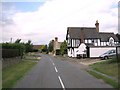
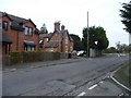


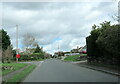
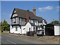
11 photos from this area
Area Information
Key information about the WR11 4TG including its size, population, and administrative classification.
- Area Type
- Postcode
- Area Size
- 99.9 hectares
- Population
- 1393
- Population Density
- 114 people/km²
House Prices in WR11 4TG
70
Properties
£404,395
Average Sold Price
£130,000
Lowest Price
£1,200,000
Highest Price
Showing 70 properties
| Address | Type | Beds | Baths | Last Sale Price | Last Sale Date | |
|---|---|---|---|---|---|---|
| Styvechale, Lenchwick Lane, Lenchwick, WR11 4TG | Bungalow | 3 | 2 | £315,000 | May 2025 | |
| Silvercloud, Lenchwick Lane, Lenchwick, WR11 4TG | Bungalow | 3 | - | £480,000 | Sep 2024 | |
| 5, Tythe Barn Cottages, Lenchwick Lane, Lenchwick, WR11 4TG | Terraced | 3 | 2 | £372,000 | Jul 2024 | |
| 4, Tythe Barn Cottages, Lenchwick Lane, Lenchwick, WR11 4TG | Terraced | 3 | 1 | £384,000 | Apr 2024 | |
| Whum, Lenchwick Lane, Lenchwick, WR11 4TG | Bungalow | 2 | 1 | £405,000 | Mar 2023 | |
| Cedry, Lenchwick Lane, Lenchwick, WR11 4TG | Bungalow | 3 | - | £625,000 | Mar 2023 | |
| Sunways, Lenchwick Lane, Lenchwick, WR11 4TG | house | - | - | £447,500 | Mar 2023 | |
| Marstann, Lenchwick Lane, Lenchwick, WR11 4TG | house | - | - | £735,000 | Sep 2022 | |
| 79 Lenchwick Lane, Lenchwick, WR11 4TG | Semi-detached | 3 | 1 | £220,000 | Jan 2022 | |
| Old Court, Lenchwick Lane, Lenchwick, WR11 4TG | Detached | - | - | £1,200,000 | Nov 2021 |
Page 1 of 7
Energy Efficiency in WR11 4TG
Amenities
Schools
| Rank | School | Type | Entry gender | Ages |
|---|
Explore more schools in this area
Go to Schools tabDemographics
Household Size
Two person
most common
Accommodation Type
Houses
most common
Tenure
64
majority
Ethnic Group
White
most common
Religion
N/A
most common
Household Composition
N/A
most common
Age
47
median
Adults (30-64 years)
most common
Household Deprivation
N/A
with no deprivation
NS-SEC
32
in Lower managerial occupations
Explore more demographic insights in this area
Go to Demographics tabPlanning
Planning Constraints
- Flood RiskPremium
- Ramsar Wetland SitesPremium
- Area of Outstanding Natural BeautyPremium
- Protected Nature ReservePremium
- Protected WoodlandPremium