Area Overview for Coleshill
Photos of Coleshill

Area Information
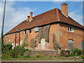
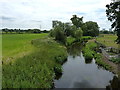
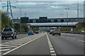
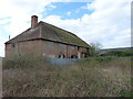
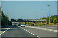
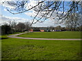
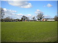
You are looking at Coleshill, a civil parish located in Warwickshire, England. The settlement sits at coordinates 52.50664, -1.709716, just north of the River Cole atop a hill. This historic town has existed since the Iron Age, with evidence of hut circles and a Romano-Celtic temple found on the original site of Grimstock Hill before the Roman conquest. Records show the settlement moved south in the post-Roman Dark Ages to its current location near the present church. Today, the parish covers an area of 14.8 km² with a population of approximately 1,517. A bronze sculpture by Peter Walker in the High Street depicts a stagecoach wheel, a circus elephant, and the creation of the Typhoo Tea brand. The town served as a major coaching staging post from London to Holyhead, operating the Coleshill-Lichfield Turnpike from 1743. It once hosted over 20 inns along the route. A railway station on the Birmingham and Derby Junction Railway opened in 1839, though the line closed to passengers in 1917. Despite its quiet size now, Coleshill retains significant historical landmarks, including a pillory and whipping post on Church Hill which were last used in 1863. Living in Coleshill means residing in a place where medieval history still borders the present day. The area offers the Coleshill Town Council as a local governance body and stands as a distinct civil parish within the wider Warwickshire landscape.
- Area Type
- Parish
- Area Size
- 14.8 km²
- Population
- Not available
- Population Density
- Not available
Demographics
The community in Coleshill reflects a specific demographic profile with a median age of 70. This figure indicates an older population structure compared to the national average. With a median age that high, the area attracts retirement-focused living or long-term residents who have stayed through the decades. The total household composition suggests a settled population rather than a transient one. Exact percentages for specific age ranges are not broken down further in the available statistics, but the overall picture points towards an elderly demographic. Home ownership stands at 72% across the parish. This high rate of ownership typically correlates with residents who have lived in their properties for many years, often earning them substantial time on the local Facebook community organically. The data indicates that the total accommodation types align with this ownership figure, suggesting a stable housing stock rather than a volatile rental market. There is no specific data provided on the predominant ethnic group or religious breakdown within the current scope. The lack of young families or transient workers is implied by the age data. You should understand that living in Coleshill involves a community where residents are likely to be established in their homes and familiar with the parish history. The total demographic picture shows a place that has evolved over centuries into a specific type of residential environment.
Household Size
Accommodation Type
Tenure
Ethnic Group
Religion
Household Composition
Age
Household Deprivation
NS-SEC
Explore more demographic insights in this area
Go to Demographics tabPlanning
Planning Constraints
- Flood RiskPremium
- Ramsar Wetland SitesPremium
- Area of Outstanding Natural BeautyPremium
- Protected Nature ReservePremium
- Protected WoodlandPremium