Area Overview for Coleshill (North Warwickshire)
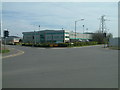
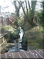
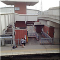
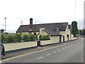
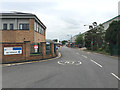
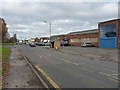
Photos of Coleshill (North Warwickshire)
Area Information
Living in Coleshill (North Warwickshire) means having a home in a compact built-up area covering just 4.6 square kilometres. This small geographic footprint creates a concentrated community where daily life revolves around established local hubs. The area sits firmly within North Warwickshire, offering a residential environment defined by its manageable scale yet strong connectivity to the wider Midlands region. For buyers seeking a settled location, Coleshill (North Warwickshire) provides a straightforward neighbourhood setting without the sprawl of larger metropolitan zones. You will find a residential landscape dominated by established housing stock, reflecting decades of development in this specific pocket of the West Midlands. The community is characterised by a high level of occupation and stability, suggesting a place where residents tend to stay and invest in their local surroundings. When you consider homes in Coleshill (North Warwickshire), you are looking at a mature environment where the town centre and immediate suburbs are closely integrated. The area does not offer the vast open spaces of the surrounding countryside but delivers a distinct sense of place within an urban context. Residents benefit from being part of a defined locality where services, schools, and transport links are within practical reach. Buying here means joining a community that functions efficiently on a smaller scale, allowing for a quieter, more focused way of life compared to the busiest sections of Birmingham. The area represents a specific slice of the North Warwickshire landscape, offering a balanced mix of town living and proximity to the wider region's opportunities.
- Area Type
- Built Up Area 250
- Area Size
- 4.6 km²
- Population
- Not available
- Population Density
- Not available
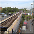
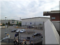
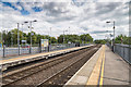
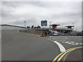
Your daily lifestyle in Coleshill (North Warwickshire) benefits from a range of retail and transport amenities located within practical reach. The area has access to five notable retail outlets, including Aldi Station, Morrisons Coleshill, and Tesco Water. These supermarkets cover everyday shopping needs from groceries to household essentials, ensuring you rarely need to travel far for basic provisions. For larger shopping trips, the three nearby railway stations—Coleshill Parkway, Water Orton, and Marston Green—offer easy access to larger retail parks and city centre outlets. If you are a frequent traveller, the two major metro destinations nearby are Birmingham International Airport and Birmingham International Railway Station. You can depart for a holiday or a business meeting with minimal travel time, accessing international flights or the InterCity network from a short distance. The character of living in Coleshill (North Warwickshire) is shaped by convenience rather than a sprawling urban core. You have five retail points close by, which suggests a neighbourhood where self-catering and local spending are the norm. This setup supports a slower pace of life where you shop from local stores and do not rely heavily on the commercial district. The transport network reinforces this independence, allowing you to leave the car at home for many journeys. Whether you are grabbing lunch at a local café after the Coleshill Railway Station or flying out from Birmingham International Airport for the weekend, your options are extensive. The presence of Aldi, Morrisons, and Tesco means you never feel isolated from essential services. The locality is designed for residents who value a mix of local independence and the freedom provided by superior public transport links.
Amenities
Schools
The educational landscape around Coleshill (North Warwickshire) consists of several primary establishments, though the older median age of the population suggests fewer young children living locally. The most notable institution is High Meadow Community School, which is a primary school holding a good Ofsted rating. This certification confirms the school meets high standards in teaching and student welfare, providing a reliable option for local families who have children. Nearby, you will also find St Edward's Catholic Primary School, which offers a faith-based education to the local community. For those seeking faith-specific education, Coleshill CofE Primary School and The Coleshill School provide dedicated denominational schooling options. Both institutions are primary schools, meaning they cater to younger students before they move to secondary education elsewhere. There is also Blythe School in the immediate vicinity, which is categorised as a special school. This facility is designed to support students with special educational needs, ensuring that all family requirements can be met within a reasonable distance. The absence of listed secondary schools within the immediate data profile for Coleshill (North Warwickshire) indicates that older children likely travel to Warwick or neighbouring towns for their further education. For families with young children living in Coleshill (North Warwickshire), the presence of multiple primary choices, including a top-rated community school, provides a solid foundation. You will appreciate that the school network is compact, with most academies located within the town limits or very close by. This concentration allows parents to keep supervision levels high and commute times short for daily drop-offs and collections.
| Rank | School | Type | Entry gender | Ages |
|---|
Explore more schools in this area
Go to Schools tabDemographics
The community in Coleshill (North Warwickshire) is defined by an exceptionally mature population profile. The median age of residents is seventy years old, indicating that the area is primarily inhabited by older adults. This demographic reality shapes the daily rhythm of the neighbourhood, with a population base that values convenience, stability, and a pace of life suited to retirement or later stages of life. When you look at the accommodation statistics, you see that seventy-six per cent of the area is owner-occupied. This high rate of home ownership points to a wealthy, settled community where residents have invested heavily in their local properties and view them as permanent homes rather than transient rentals. The household composition reflects this age profile, with fewer young families and a concentration of single-person households or couples without children. Unlike many newer London.extensions or commuter towns, this area does not draw a steady stream of young professionals seeking flights. Instead, the demographic structure suggests a legacy community where people have stayed for generations. The high ownership rate also implies that the local economy benefits from a stable occupant base, though the very low number of younger residents may affect the vibrancy of local evening spaces. Living in Coleshill (North Warwickshire) involves joining a quiet, established group where the cultural life is likely centred around daytime activities and traditional community events. The eighty-four per cent mobile coverage score supports an independent lifestyle for those who wish to remain mobile while living in this senior-focused environment.