Area Overview for North Warwickshire District (B)
Photos of North Warwickshire District (B)
Area Information
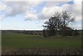
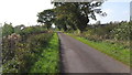
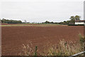
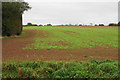
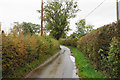
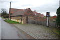
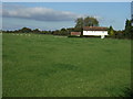
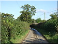
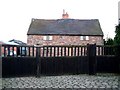
North Warwickshire District (B) covers an area of 284.5 km², making it a substantial local authority district within England. You will find that daily life here revolves around a quiet, established environment where pace is moderate. The landscape provides a backdrop for residents who enjoy outdoor living without the intensity of urban centres. Your experience living in North Warwickshire District (B) is defined by the presence of protected areas, specifically one patch of protected woodland that covers a notable portion of the district. This green space offers local recreational opportunities and shapes the character of the neighbourhood. The community feels settled, reflecting the long-standing residential nature of the borough. There are no Ramsar wetland sites or Areas of Outstanding Natural Beauty within the boundaries, meaning planning constraints are relatively low compared to coastal or high-conservation zones. However, the existence of the protected woodland does introduce a specific planning consideration for future development. Homes in North Warwickshire District (B) benefit from a clear separation from other significant natural designations, allowing for a distinct local identity. You can expect a residential atmosphere where the focus remains on established communities rather than rapid transformation. The district status ensures that local governance handles specific needs for this large rural area effectively.
- Area Type
- District/Borough
- Area Size
- 284.5 km²
- Population
- Not available
- Population Density
- Not available
Demographics
The community in North Warwickshire District (B) has a distinct age profile that sets it apart from many other British districts. The median age here stands at 70 years, indicating a population skewed heavily towards older adults. Most of the residents fall into the "Total" age bracket as recorded in the primary household composition data, suggesting a stable, less transient population structure than cities. This demographic reality shapes the social fabric and available services. You are likely to encounter a neighbourhood where long-term settlement is the norm. Home ownership is entrenched in this area, with 71% of households owning their properties outright or with a mortgage. This high level of ownership creates a community where families and individuals tend to stay put for significant periods. The remaining 29% of households involve other tenure types, but the overwhelming majority possess a stake in the property. This statistic contrasts sharply with high-rent urban areas and points to a market driven by purchase rather than short-term leasing. The predominance of owner-occupiers influences the tend to maintain the character of the streets and local amenities. Diversity data recorded for the district indicates a total composition for predominant ethnic groups and religious affiliations. While specific breakdowns are not detailed in the primary records, the overall trends align with a broad community makeup. The household composition reflects a total count that mirrors the settled nature of the 284.5 km² area. Living here means joining a community where privacy and established routines are paramount. The demographic stability suggests a low influx of new residents, which fosters a tight-knit, albeit aging, society. For anyone considering moving, understanding this age dynamic is crucial for accessing local services and understanding the social environment.
Household Size
Accommodation Type
Tenure
Ethnic Group
Religion
Household Composition
Age
Household Deprivation
NS-SEC
Explore more demographic insights in this area
Go to Demographics tabPlanning
Planning Constraints
- Flood RiskPremium
- Ramsar Wetland SitesPremium
- Area of Outstanding Natural BeautyPremium
- Protected Nature ReservePremium
- Protected WoodlandPremium