Area Overview for Nuneaton and Bedworth District (B)
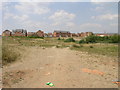
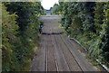
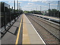
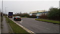
Photos of Nuneaton and Bedworth District (B)


Area Information
Nuneaton and Bedworth District (B) covers a compact 79.0 km² area within England, presenting a specific reality for prospective residents. Living in this district means navigating a locality defined by clear limitations in its digital infrastructure and notable safety concerns. You will find a setting where standard precautions are advisable due to medium crime risks, and where fixed broadband quality falls short of modern expectations for remote work. Despite these challenges, the area functions as a distinct local authority unit where ownership dominates the housing landscape. Daily life here involves balancing the practicalities of lower connectivity scores with the stability of a property market heavily skewed towards owners. The district lacks extensive protected natural constraints like Ramsar sites or Areas of Outstanding Natural Beauty, meaning planning is not inherently hindered by these specific environmental protections. However, the presence of protected woodland within the area suggests a commitment to preserving some green spaces. For anyone considering homes in Nuneaton and Bedworth District (B), you must weigh the solid ground of ownership rates against the genuine need to upgrade home digital capabilities. The district offers a straightforward, albeit imperfect, living environment where facts matter more than marketing promises.
- Area Type
- District/Borough
- Area Size
- 79.0 km²
- Population
- Not available
- Population Density
- Not available
Demographics
The community within Nuneaton and Bedworth District (B) reflects a significant demographic shift towards an older population. The median age stands at 70, indicating that the majority of residents are well into retirement. This profile shapes the daily rhythm of the district, where households are likely structured around later-life needs rather than young families. Home ownership remains the prevailing norm, with 69% of residents owning their properties outright or with a mortgage. This high ownership rate contrasts sharply with regions where rentals dominate, suggesting a stable, settled population. The data does not specify household composition types beyond the age profile, so the image you have is one of older, owner-occupied homes. While specific ethnic groups and religious statistics are not provided in the current dataset, the USAGov profile acts as a lookup tool for those seeking deeper insights into diversity. You should note that the most common age range is simply listed as 'Age: Total', which reinforces the broad age distribution rather than pinpointing a specific youthful cohort. Living in this area means joining a community where the primary demographic is over 70 years old, and where the social fabric is built around this life stage. Deprivation figures are not included, but the clear age skew presents a distinct lifestyle context for anyone moving to Nuneaton and Bedworth District (B).
Household Size
Accommodation Type
Tenure
Ethnic Group
Religion
Household Composition
Age
Household Deprivation
NS-SEC
Explore more demographic insights in this area
Go to Demographics tabPlanning
Planning Constraints
- Flood RiskPremium
- Ramsar Wetland SitesPremium
- Area of Outstanding Natural BeautyPremium
- Protected WoodlandPremium
- Crime RiskPremium