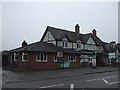
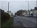
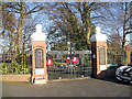
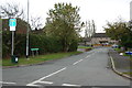
Area Overview for Great Wyrley
Photos of Great Wyrley

Area Information
Great Wyrley stands as a compact civil parish covering an area of just 5.6 square kilometres. This small geographical footprint means the community remains closely knit, yet it supports a population of 2,831 residents. You will find a neighbourhood where density is relatively high, with approximately 507 people per square kilometre. This concentration creates a parish where neighbours are likely to be within eyesight or a short walk away. Living in Great Wyrley involves navigating a defined rural settlement without the sprawl of larger districts. The civil parish structure suggests stable local governance and a clear sense of boundaries between properties. You move through an environment where the number of households is proportionate to the land available. This setting discourages the anonymity often found in bigger towns. Instead, daily life unfolds in a contained space where local infrastructure serves the entire population efficiently. The parish nature of Great Wyrley means services and amenities are organised to meet the specific needs of its 2,831 inhabitants. There is no ambiguity about the scale of the community; it is small enough to know your surroundings but large enough to function independently. For anyone considering homes in Great Wyrley, the size of the parish offers a predictable landscape. You can expect a straightforward geography without the complexity of sprawling districts. The population size ensures that local projects receive sufficient focus while maintaining a manageable pace of life.
- Area Type
- Parish
- Area Size
- 5.6 km²
- Population
- 2831
- Population Density
- 507 people/km²
Demographics
The community within Great Wyrley is characterised by a significantly older population. Data indicates a median age of 70 years old, which marks a distinct demographic profile compared to many urban centres. This age profile suggests that you are likely joining a retirement community or a village with a strong presence of older residents. The most common age range across the total population aligns with this higher median figure, indicating a settled, mature community. Home ownership stands at 75 per cent, which is a very high proportion for any residential area. Such a figure implies that most residents purchased their current homes and have established long-term roots in the parish. This level of ownership usually correlates with stability in the local estate as people are less inclined to move frequently. You will find that accommodation types reflect these independent living arrangements. The total household composition and total accommodation type data support a picture of established families and retirees. While specific figures for ethnic groups and religions are recorded as totals within the dataset, the dominance of home ownership shapes the social fabric. A 75 per cent ownership rate provides a sense of permanence to the area. This demographic reality means that any new homebuyer is entering a space defined by longevity and local attachment. The age skew also influences what local businesses thrive, catering primarily to an older demographic.
Household Size
Accommodation Type
Tenure
Ethnic Group
Religion
Household Composition
Age
Household Deprivation
NS-SEC
Explore more demographic insights in this area
Go to Demographics tabPlanning
Planning Constraints
- Flood RiskPremium
- Ramsar Wetland SitesPremium
- Area of Outstanding Natural BeautyPremium
- Protected Nature ReservePremium
- Protected WoodlandPremium
- Crime RiskPremium