Area Overview for Great Wyrley and Cheslyn Hay
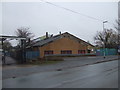
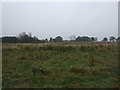
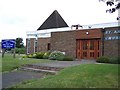
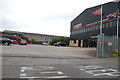
Photos of Great Wyrley and Cheslyn Hay
Area Information
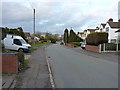
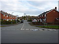
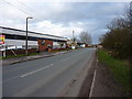
Living in Great Wyrley and Cheslyn Hay means residing in a built-up area defined by its manageable scale and established community character. This locality occupies 4.8 square kilometres of land within the wider region of Staffordshire, England. With a total population of 1,500 residents, the density stands at 314 people per square kilometre, ensuring a layout that avoids the congestion of larger urban centres while maintaining essential local services. You will find that daily life here is shaped by a close-knit environment where neighbours often know names, and the wider town feels within comfortable walking or short driving distance. The area serves as a residential hub for those seeking a tranquil setting without complete isolation from the road network. Homes are situated in a setting that has evolved over time, creating a distinct identity separate from the motorways that border the broader West Midlands corridor. For a buyer looking for a place with a defined perimeter and a clear sense of place, Great Wyrley and Cheslyn Hay offers a straightforward proposition. The compact nature of the built-up area ensures that travel times to nearby towns like Cannock or Bloxwich remain predictable. You do not need to drive far to access your routine destinations, which supports a lifestyle centred more on local interaction than long-distance commuting from a central city.
- Area Type
- Built Up Area 250
- Area Size
- 4.8 km²
- Population
- 1500
- Population Density
- 314 people/km²
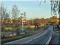
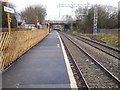
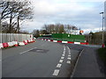
Residents of Great Wyrley and Cheslyn Hay enjoy access to a curated selection of amenities within practical reach of their homes. For daily shopping needs, you can visit specific retailers such as the Co-op Great, Spar, and Co-op Cheslyn, offering five retail outlets in the immediate vicinity. These shops provide essential groceries and household goods, meaning you can run your errands without travelling to a distant town centre. Beyond shopping, rail connectivity is well-established with five stations serving the area, including Landywood Railway Station, Cannock Railway Station, and Bloxwich North Railway Station. These stations facilitate easy access to wider networks and neighbouring towns. While the data does not list specific parks or leisure centres, the presence of these transport links and local shops defines the convenience of living here. You do not need a car for every trip to the supermarket or to catch a train. The proximity of these services ensures that daily life remains manageable and reduces the stress of logistics. The character of the area is defined by this functional approach to convenience, where key services are nearby. This setup supports a slower pace of life while maintaining the ability to commute or travel when necessary.
Amenities
Schools
Families looking at schools near Great Wyrley and Cheslyn Hay have access to a mix of primary institutions, several of which hold government ratings. Glenthorne Community Primary School has received a good Ofsted rating, confirming its educational standards. Landywood Primary School also holds a good Ofsted rating, providing another rated option for those living closer to that specific settlement. These schools offer localducation for the younger residents in the area. You will also find Cheslyn Hay Primary School, Moat Hall Primary School, and St Thomas More Catholic Primary School serving the local catchment. While only three of the five listed schools have explicit Ofsted ratings in the data, the presence of multiple primary institutions ensures that family life remains accessible without requiring lengthy daily commutes. St Thomas More Catholic Primary School caters to families seeking faith-based education within the local system. The mix of school types means you have choices between community schools and faith schools nearby. For parents in Great Wyrley, the distance to these schools is a key factor, as the options provided sit within practical reach of the built-up area. The availability of several primaries in close proximity is a significant advantage for families with multiple children or those seeking specific educational philosophies.
| Rank | School | Type | Entry gender | Ages |
|---|
Explore more schools in this area
Go to Schools tabDemographics
The community profile of Great Wyrley and Cheslyn Hay reveals a population with a significant lean towards older residents. The median age is 70 years, which places this locality well above the national average. This demographic shift indicates that the area is a primary choice for retirement living or long-term residence for those in their later decades. While the specific breakdown by age range is listed simply as "Total" in the available data, the high median age strongly suggests a quiet, site remains peaceful during weekday afternoons and evenings. You will find that the population is predominantly settled rather than transient, fostering a stable social environment. Home ownership stands at 78%, a figure that confirms the majority of households have already bought their homes. This high rate of ownership contributes to the stable nature of the community and suggests that long-term residents view their homes as a permanent base. The area does not appear to cater heavily to students or young professionals in terms of age distribution. Instead, it functions as a borough for those who have settled down. The accommodation composition and household totals reflect this mature demographic, with families and individuals prioritising established neighbourhoods over the rapid lifestyle changes associated with younger age groups.
Household Size
Accommodation Type
Tenure
Ethnic Group
Religion
Household Composition
Age
Household Deprivation
NS-SEC
Explore more demographic insights in this area
Go to Demographics tabPlanning
Planning Constraints
- Crime RiskPremium