Area Overview for Silverdale
Photos of Silverdale


Area Information
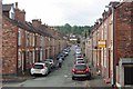
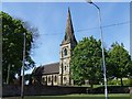
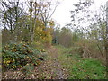
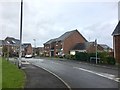
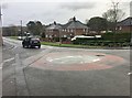
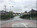
Silverdale is a small civil parish covering 3.7 km² in England. This modest size gives the area a contained feel, yet it offers a complete set of amenities for those seeking a quiet residence. Living in Silverdale means you will be part of a community defined by stability and tradition. The local environment allows for a relaxed pace of life without the distractions of larger towns. You will find that daily errands are manageable within this compact footprint, encouraging a lifestyle where walks through the parish become part of your routine. The character of Silverdale is shaped by its long-term residents. The demographic profile indicates that this is not a transient locality but a place where people stay for decades. When you consider homes in Silvelade, you are joining an established stretch of neighbourhood where change happens slowly. This consistency provides a predictable backdrop for raising a family or enjoying retirement. The area avoids the chaos of rapid development, allowing you to focus on your immediate surroundings. Every street corner tells a story of continuity, reinforcing the sense that this is a place rooted deeply in local history.
- Area Type
- Parish
- Area Size
- 3.7 km²
- Population
- Not available
- Population Density
- Not available
Demographics
The community structure of Silverdale reflects a distinct settlement of mature residents. The median age stands at 70 years old, confirming that this is a retirement-focused location. The most common age range aligns with this high median, meaning you will encounter seniors throughout the parish. This age profile suggests that the streets are filled with individuals in the later stages of life rather than young children or teenagers. Consequently, the social atmosphere revolves around the interests and needs of older adults. Home ownership defines the social fabric here. Over 61% of residents own their homes outright. This high rate of ownership indicates that the majority of households have lived in the area for many years. It also signals that the market in Silverdale is driven by settled families rather than short-term tenants. You will find that neighbours here have likely known each other for generations. The household composition supports this static picture, with traditional family units and single-person households being the norm. When you think about living in Silverdale, you expect a quiet, owner-occupied environment. The area lacks the transient marker of high rental occupancy, ensuring a stable community dynamic.
Household Size
Accommodation Type
Tenure
Ethnic Group
Religion
Household Composition
Age
Household Deprivation
NS-SEC
Explore more demographic insights in this area
Go to Demographics tabPlanning
Planning Constraints
- Flood RiskPremium
- Ramsar Wetland SitesPremium
- Area of Outstanding Natural BeautyPremium
- Protected Nature ReservePremium
- Protected WoodlandPremium