Area Overview for Newcastle-under-Lyme
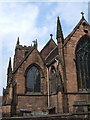
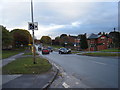
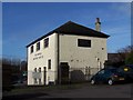
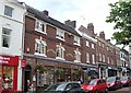
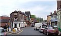
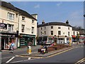
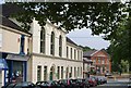
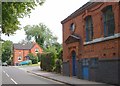
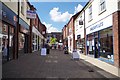
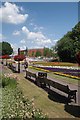
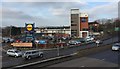
Photos of Newcastle-under-Lyme

Area Information
Living in Newcastle-under-Lyme means residing within a compact built-up area that covers 20.3 square kilometres. This town represents a significant settlement with a total population of 14,613 people. The landscape supports a density of 719 people per square kilometre, creating a sense of proximity without the crushing congestion often found in larger urban centres. You will find an environment that functions as a self-contained community rather than a sprawling metropolis. The town offers a distinct character rooted in its established footprint and moderate size. Daily life here revolves around the practicalities of a town where services are within reach of most residents. The area's built nature ensures that infrastructure is concentrated, making routine tasks efficient. When you consider homes in Newcastle-under-Lyme, you are choosing a location defined by its manageable scale and clear boundaries. The population density speaks to an established residential pattern that has deepened over time. This balance between space and community access defines the everyday experience for those making this location their home.
- Area Type
- Built Up Area 250
- Area Size
- 20.3 km²
- Population
- 14613
- Population Density
- 719 people/km²
Your daily life in Newcastle-under-Lyme benefits from immediate access to a range of retail and leisure facilities. Practical convenience is the priority, with five major retail sites located within practical reach. You can shop at Morrisons Lower Milehouse, Sainsburys Newcastle, and Lidl Central Newcastle-under-Lyme for your essential groceries and household needs. These five locations form the commercial heart of the town, eliminating long queues at supermarkets or the need to drive out of the borough. Nearby amenities also include five rail stations, providing straightforward public transport links. The concentration of these amenities ensures that you do not need to travel far for basic necessities. Whether you are picking up fresh produce at a local branch or catching a train connection, the infrastructure supports an efficient routine. The town's layout places these services close to residential areas, fostering a lifestyle where work, school runs, and shopping happen within a short timeframe.
Amenities
Schools
Families considering schools near Newcastle-under-Lyme will find several options within the local education landscape. You have access to Langdale Nursery School, Dragon Square Nursery School, and Oaklands Nursery School for early childhood education. Each of these institutions serves the youngest members of the community, providing the first step in a child's academic journey. For primary education, Bradwell County Primary School stands as a key facility serving the town's younger pupils. The Newcastle Educational Assessment Centre also operates within the area, offering additional support services to the local student population. This mix of nurseries and a primary school indicates that your children can receive education locally without the need to travel far into Stoke or another council area. The presence of multiple nursery providers suggests competition and choice for parents seeking early years care. While the data lists a specific primary school, the total count of schools in the immediate vicinity points to a fully functional local education network.
| Rank | School | Type | Entry gender | Ages |
|---|
Explore more schools in this area
Go to Schools tabDemographics
The community profile within Newcastle-under-Lyme reflects a settled population with a median age of 70 years. This figure indicates a resident base significantly older than the national average, suggesting a town populated by retirees or long-term residents. You will find that the age distribution is heavily weighted towards older demographics, shaping the local culture and services accordingly. Home ownership stands at a substantial 65 per cent of households, confirming that the majority of residents own their properties outright or through a mortgage. This high rate eliminates the prevalence of student rentals or transient populations common in university towns. The household composition data marks the total category, indicating a comprehensive mix of family units, couples, and single occupants typical of a mature town. Accommodation types also cover the total available stock, reflecting a variety of housing options suited to different family sizes. The demographic picture presents a stable, rooted community where long-term residency is the norm. Living in Newcastle-under-Lyme involves engaging with a society where traditions and established neighbourhood ties hold considerable weight.