Area Overview for ST15 8LQ
Photos of ST15 8LQ
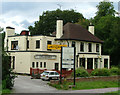
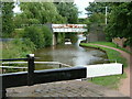
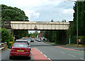
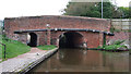

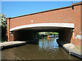
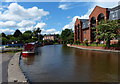
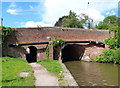
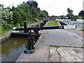
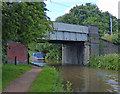
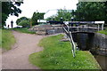
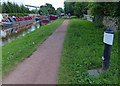
100 photos from this area
Area Information
Key information about the ST15 8LQ including its size, population, and administrative classification.
- Area Type
- Postcode
- Area Size
- 6.7 hectares
- Population
- 2413
- Population Density
- 2785 people/km²
House Prices in ST15 8LQ
64
Properties
£180,000
Average Sold Price
£180,000
Lowest Price
£180,000
Highest Price
Showing 64 properties
| Address | Type | Beds | Baths | Last Sale Price | Last Sale Date | |
|---|---|---|---|---|---|---|
| Kilmory, Whitebridge Lane, Stone, ST15 8LQ | Land | 1 | - | £180,000 | Jul 2006 | |
| 1 Whitebridge Lane, Stone, ST15 8LQ | Detached | 4 | 2 | - | - | |
| Narrowboat The Mutleycrew, Lime Kiln Basin, Whitebridge Lane, Stone, ST15 8LQ | Detached | 4 | 2 | - | - | |
| Narrowboat Infinity And Beyond, Lime Kiln Basin, Whitebridge Lane, Stone, ST15 8LQ | Detached | 4 | 2 | - | - | |
| Narrowboat Woolhampton, Lime Kiln Basin, Whitebridge Lane, Stone, ST15 8LQ | Houseboat | - | - | - | - | |
| Narrowboat Andromeda, Lime Kiln Basin, Whitebridge Lane, Stone, ST15 8LQ | Houseboat | - | - | - | - | |
| Laurel Cottage, Whitebridge Lane, Stone, ST15 8LQ | Detached | - | - | - | - | |
| Railway Crossing Gate Keepers Cottage, Whitebridge Lane, Stone, ST15 8LQ | Detached | - | - | - | - | |
| Narrowboat Grey Lady, Lime Kiln Basin, Whitebridge Lane, Stone, ST15 8LQ | Houseboat | - | - | - | - | |
| Unit 10C, Whitebridge Industrial Estate, Whitebridge Lane, Stone, ST15 8LQ | Office | - | - | - | - |
Page 1 of 7
Energy Efficiency in ST15 8LQ
Amenities
Schools
| Rank | School | Type | Entry gender | Ages |
|---|
Explore more schools in this area
Go to Schools tabDemographics
Household Size
Two person
most common
Accommodation Type
Houses
most common
Tenure
74
majority
Ethnic Group
White
most common
Religion
N/A
most common
Household Composition
N/A
most common
Age
47
median
Adults (30-64 years)
most common
Household Deprivation
N/A
with no deprivation
NS-SEC
47
in Lower managerial occupations
Explore more demographic insights in this area
Go to Demographics tabPlanning
Planning Constraints
- Flood RiskPremium
- Ramsar Wetland SitesPremium
- Area of Outstanding Natural BeautyPremium
- Protected Nature ReservePremium
- Protected WoodlandPremium