Area Overview for ST15 0NS
Photos of ST15 0NS
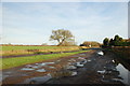
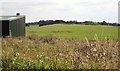
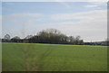
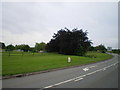
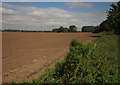
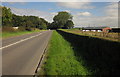
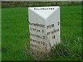
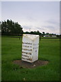
12 photos from this area
Area Information
Key information about the ST15 0NS including its size, population, and administrative classification.
- Area Type
- Postcode
- Area Size
- 3.9 km²
- Population
- 2331
- Population Density
- 129 people/km²
House Prices in ST15 0NS
30
Properties
£275,000
Average Sold Price
£45,000
Lowest Price
£445,000
Highest Price
Showing 30 properties
| Address | Type | Beds | Baths | Last Sale Price | Last Sale Date | |
|---|---|---|---|---|---|---|
| Riverside, Stone Road, Norton Bridge, Stone, ST15 0NS | Detached | 4 | 2 | £445,000 | Jun 2023 | |
| Whitehouse Farmhouse, Eccleshall Road, Norton Bridge, Stone, ST15 0NS | Detached | 4 | 1 | £45,000 | Dec 2019 | |
| Rose Tree Farm, Stone Road, Norton Bridge, Stone, ST15 0NS | Detached | 3 | - | £180,000 | Jul 2019 | |
| The Lodge, Eccleshall Road, Norton Bridge, Stone, ST15 0NS | Detached | 4 | 3 | £310,000 | Feb 2011 | |
| Little Acre, Eccleshall Road, Norton Bridge, Stone, ST15 0NS | Detached | - | - | £395,000 | Jun 2002 | |
| Caravan At Hammer House Farm, Smithy Lane, Norton Bridge, Stone, ST15 0NS | Equestrian | - | - | - | - | |
| The Old Police House, 10 Stone Road, Norton Bridge, Stone, ST15 0NS | Detached | 3 | - | - | - | |
| The Gables, Eccleshall Road, Norton Bridge, Stone, ST15 0NS | Detached | 4 | 1 | - | - | |
| Hammer House Farm, Smithy Lane, Norton Bridge, Stone, ST15 0NS | house | 4 | - | - | - | |
| THE OLD STABLES, ECCLESHALL ROAD, Norton Bridge, Stone, ST15 0NS | Detached | - | - | - | - |
Page 1 of 3
Energy Efficiency in ST15 0NS
Amenities
Schools
| Rank | School | Type | Entry gender | Ages |
|---|
Explore more schools in this area
Go to Schools tabDemographics
Household Size
Two person
most common
Accommodation Type
Houses
most common
Tenure
71
majority
Ethnic Group
White
most common
Religion
N/A
most common
Household Composition
N/A
most common
Age
47
median
Adults (30-64 years)
most common
Household Deprivation
N/A
with no deprivation
NS-SEC
43
in Lower managerial occupations
Explore more demographic insights in this area
Go to Demographics tabPlanning
Planning Constraints
- Flood RiskPremium
- Ramsar Wetland SitesPremium
- Area of Outstanding Natural BeautyPremium
- Protected Nature ReservePremium
- Protected WoodlandPremium