Area Overview for ST15 0SX
Photos of ST15 0SX
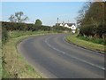
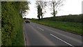
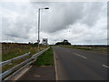
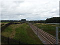
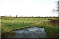
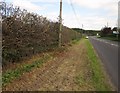
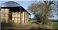
7 photos from this area
Area Information
Key information about the ST15 0SX including its size, population, and administrative classification.
- Area Type
- Postcode
- Area Size
- 65.0 hectares
- Population
- 2331
- Population Density
- 129 people/km²
House Prices in ST15 0SX
37
Properties
£260,843
Average Sold Price
£107,500
Lowest Price
£520,000
Highest Price
Showing 37 properties
| Address | Type | Beds | Baths | Last Sale Price | Last Sale Date | |
|---|---|---|---|---|---|---|
| 8 De Havilland Drive, Yarnfield, Stone, ST15 0SX | Detached | 4 | 2 | £445,000 | Aug 2025 | |
| 23 De Havilland Drive, Yarnfield, Stone, ST15 0SX | Detached | 4 | 2 | £520,000 | Nov 2024 | |
| 10 De Havilland Drive, Yarnfield, Stone, ST15 0SX | Detached | 4 | 2 | £466,000 | Aug 2022 | |
| 16 De Havilland Drive, Yarnfield, Stone, ST15 0SX | house | - | - | £387,500 | Mar 2022 | |
| 22 De Havilland Drive, Yarnfield, Stone, ST15 0SX | house | - | - | £397,500 | Jun 2021 | |
| 33 De Havilland Drive, Yarnfield, Stone, ST15 0SX | Detached | 4 | 2 | £390,000 | Mar 2021 | |
| 37 De Havilland Drive, Yarnfield, Stone, ST15 0SX | Detached | 4 | 2 | £385,000 | May 2018 | |
| 11 De Havilland Drive, Yarnfield, Stone, ST15 0SX | Detached | 4 | 2 | £330,000 | Dec 2016 | |
| 39 De Havilland Drive, Yarnfield, Stone, ST15 0SX | Detached | 5 | 1 | £340,000 | Mar 2016 | |
| 19 De Havilland Drive, Yarnfield, Stone, ST15 0SX | Detached | 4 | 2 | £374,000 | Nov 2015 |
Page 1 of 4
Energy Efficiency in ST15 0SX
Amenities
Schools
| Rank | School | Type | Entry gender | Ages |
|---|
Explore more schools in this area
Go to Schools tabDemographics
Household Size
Two person
most common
Accommodation Type
Houses
most common
Tenure
71
majority
Ethnic Group
White
most common
Religion
N/A
most common
Household Composition
N/A
most common
Age
47
median
Adults (30-64 years)
most common
Household Deprivation
N/A
with no deprivation
NS-SEC
43
in Lower managerial occupations
Explore more demographic insights in this area
Go to Demographics tabPlanning
Planning Constraints
- Flood RiskPremium
- Ramsar Wetland SitesPremium
- Area of Outstanding Natural BeautyPremium
- Protected Nature ReservePremium
- Protected WoodlandPremium