Area Overview for ST1 6DB
Photos of ST1 6DB

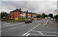

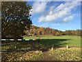
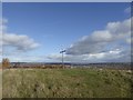
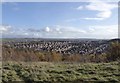
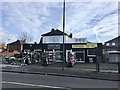
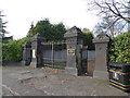
40 photos from this area
Area Information
Key information about the ST1 6DB including its size, population, and administrative classification.
- Area Type
- Postcode
- Area Size
- 8768 m²
- Population
- 1523
- Population Density
- 4921 people/km²
House Prices in ST1 6DB
12
Properties
£94,333
Average Sold Price
£29,000
Lowest Price
£150,000
Highest Price
Showing 12 properties
| Address | Type | Beds | Baths | Last Sale Price | Last Sale Date | |
|---|---|---|---|---|---|---|
| 198 Hanley Road, Sneyd Green, Stoke On Trent, ST1 6DB | house | - | - | £150,000 | Mar 2022 | |
| 200 Hanley Road, Sneyd Green, Stoke On Trent, ST1 6DB | Semi-detached | 3 | 1 | £80,000 | Jul 2021 | |
| 212 Hanley Road, Sneyd Green, Stoke On Trent, ST1 6DB | house | 3 | - | £116,000 | May 2013 | |
| 206 Hanley Road, Sneyd Green, Stoke On Trent, ST1 6DB | Semi-detached | 5 | 1 | £150,000 | Jan 2013 | |
| 202 Hanley Road, Sneyd Green, Stoke On Trent, ST1 6DB | Semi-detached | - | - | £41,000 | Sep 1996 | |
| 210 Hanley Road, Sneyd Green, Stoke On Trent, ST1 6DB | Semi-detached | - | - | £29,000 | Dec 1995 | |
| 204 Hanley Road, Sneyd Green, Stoke On Trent, ST1 6DB | Detached | 4 | 1 | - | - | |
| 220 Hanley Road, Sneyd Green, Stoke On Trent, ST1 6DB | Detached | 3 | 1 | - | - | |
| Living Accommodation, The Sneyd Arms, Hanley Road, Sneyd Green, Stoke On Trent, ST1 6DB | Flat | - | - | - | - | |
| The Sneyd Arms, Hanley Road, Sneyd Green, Stoke On Trent, ST1 6DB | restaurant_cafe | - | - | - | - |
Page 1 of 2
Energy Efficiency in ST1 6DB
Amenities
Schools
| Rank | School | Type | Entry gender | Ages |
|---|
Explore more schools in this area
Go to Schools tabDemographics
Household Size
Two person
most common
Accommodation Type
Houses
most common
Tenure
86
majority
Ethnic Group
White
most common
Religion
N/A
most common
Household Composition
N/A
most common
Age
47
median
Adults (30-64 years)
most common
Household Deprivation
N/A
with no deprivation
NS-SEC
27
in Lower managerial occupations
Explore more demographic insights in this area
Go to Demographics tabPlanning
Planning Constraints
- Flood RiskPremium
- Ramsar Wetland SitesPremium
- Area of Outstanding Natural BeautyPremium
- Protected Nature ReservePremium
- Protected WoodlandPremium