Area Overview for ST1 6HD
Photos of ST1 6HD

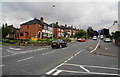

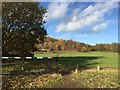
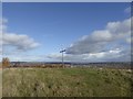
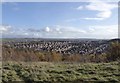


40 photos from this area
Area Information
Key information about the ST1 6HD including its size, population, and administrative classification.
- Area Type
- Postcode
- Area Size
- 1.3 hectares
- Population
- 1424
- Population Density
- 4875 people/km²
House Prices in ST1 6HD
58
Properties
£97,941
Average Sold Price
£12,000
Lowest Price
£270,000
Highest Price
Showing 58 properties
| Address | Type | Beds | Baths | Last Sale Price | Last Sale Date | |
|---|---|---|---|---|---|---|
| 96 Milton Road, Sneyd Green, Stoke On Trent, ST1 6HD | Semi-detached | 3 | 1 | £172,000 | Dec 2023 | |
| 22 Milton Road, Sneyd Green, Stoke On Trent, ST1 6HD | Terraced | 2 | - | £70,500 | May 2023 | |
| 84 Milton Road, Sneyd Green, Stoke On Trent, ST1 6HD | Terraced | 2 | 1 | £160,000 | Jun 2022 | |
| 94 Milton Road, Sneyd Green, Stoke On Trent, ST1 6HD | Terraced | 3 | 1 | £185,000 | May 2022 | |
| 28 Milton Road, Sneyd Green, Stoke On Trent, ST1 6HD | Terraced | 2 | 1 | £81,500 | Jan 2022 | |
| 120 Milton Road, Sneyd Green, Stoke On Trent, ST1 6HD | house | - | - | £180,000 | Dec 2021 | |
| 52 Milton Road, Sneyd Green, Stoke On Trent, ST1 6HD | Terraced | 2 | 1 | £90,000 | Aug 2021 | |
| 126 Milton Road, Sneyd Green, Stoke On Trent, ST1 6HD | Semi-detached | 3 | 1 | £148,000 | Nov 2019 | |
| 90 Milton Road, Sneyd Green, Stoke On Trent, ST1 6HD | Terraced | 3 | 1 | £129,950 | Apr 2018 | |
| 102 Milton Road, Sneyd Green, Stoke On Trent, ST1 6HD | Semi-detached | 3 | 1 | £127,000 | Jan 2018 |
Page 1 of 6
Energy Efficiency in ST1 6HD
Amenities
Schools
| Rank | School | Type | Entry gender | Ages |
|---|
Explore more schools in this area
Go to Schools tabDemographics
Household Size
Two person
most common
Accommodation Type
Houses
most common
Tenure
81
majority
Ethnic Group
White
most common
Religion
N/A
most common
Household Composition
N/A
most common
Age
47
median
Adults (30-64 years)
most common
Household Deprivation
N/A
with no deprivation
NS-SEC
22
in Lower managerial occupations
Explore more demographic insights in this area
Go to Demographics tabPlanning
Planning Constraints
- Flood RiskPremium
- Ramsar Wetland SitesPremium
- Area of Outstanding Natural BeautyPremium
- Protected Nature ReservePremium
- Protected WoodlandPremium