Area Overview for HR9 6QA
Photos of HR9 6QA
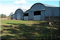
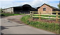
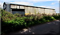
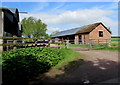
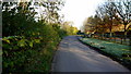
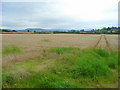
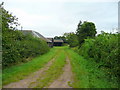
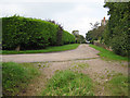
10 photos from this area
Area Information
Key information about the HR9 6QA including its size, population, and administrative classification.
- Area Type
- Postcode
- Area Size
- 90.4 hectares
- Population
- 1553
- Population Density
- 70 people/km²
House Prices in HR9 6QA
33
Properties
£287,167
Average Sold Price
£74,500
Lowest Price
£590,000
Highest Price
Showing 33 properties
| Address | Type | Beds | Baths | Last Sale Price | Last Sale Date | |
|---|---|---|---|---|---|---|
| Bridstow Market Gardens, C 1271 Baysham To Bridstow, Bridstow, HR9 6QA | house | - | - | £590,000 | Aug 2021 | |
| Fern Cottage, C 1271 Baysham To Bridstow, Bridstow, HR9 6QA | Detached | - | - | £197,000 | May 1997 | |
| Langetts Cottage, C 1271 Baysham To Bridstow, Bridstow, HR9 6QA | Detached | - | - | £74,500 | Feb 1997 | |
| 7 Ashe Ingen Mews, Bridstow, HR9 6QA | Bungalow | 2 | 1 | - | - | |
| Newton Barn, 9 Ashe Ingen Mews, Bridstow, HR9 6QA | house | 4 | 1 | - | - | |
| Ashe Ingen Court, Ashe Ingen Mews, Bridstow, HR9 6QA | Semi-detached | 3 | - | - | - | |
| Cottage, 1 Ashe Ingen Mews, Bridstow, HR9 6QA | Semi-detached | - | - | - | - | |
| Ashe Ingen Farm Cottage, Ashe Ingen Mews, Bridstow, HR9 6QA | Terraced | - | - | - | - | |
| 2 Ashe Ingen Mews, Bridstow, HR9 6QA | Semi-detached | - | - | - | - | |
| Ashe Ingen Court Bungalow, C 1271 Baysham To Bridstow, Bridstow, HR9 6QA | Bungalow | - | - | - | - |
Page 1 of 4
Energy Efficiency in HR9 6QA
Amenities
Schools
| Rank | School | Type | Entry gender | Ages |
|---|
Explore more schools in this area
Go to Schools tabDemographics
Household Size
Two person
most common
Accommodation Type
Houses
most common
Tenure
78
majority
Ethnic Group
White
most common
Religion
N/A
most common
Household Composition
N/A
most common
Age
47
median
Adults (30-64 years)
most common
Household Deprivation
N/A
with no deprivation
NS-SEC
39
in Lower managerial occupations
Explore more demographic insights in this area
Go to Demographics tabPlanning
Planning Constraints
- Flood RiskPremium
- Ramsar Wetland SitesPremium
- Protected Nature ReservePremium
- Protected WoodlandPremium