Area Overview for HR2 7UJ
Photos of HR2 7UJ


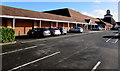
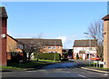
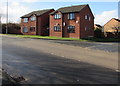
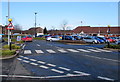
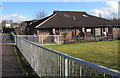
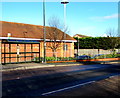
46 photos from this area
Area Information
Key information about the HR2 7UJ including its size, population, and administrative classification.
- Area Type
- Postcode
- Area Size
- 2.0 hectares
- Population
- 1542
- Population Density
- 2899 people/km²
House Prices in HR2 7UJ
52
Properties
£125,955
Average Sold Price
£43,000
Lowest Price
£238,000
Highest Price
Showing 52 properties
| Address | Type | Beds | Baths | Last Sale Price | Last Sale Date | |
|---|---|---|---|---|---|---|
| 18 Westholme Road, Belmont, HR2 7UJ | Detached | 3 | 1 | £215,000 | Nov 2025 | |
| 8 Westholme Road, Belmont, HR2 7UJ | Semi-detached | 3 | 1 | £238,000 | Nov 2025 | |
| 27 Westholme Road, Belmont, HR2 7UJ | Terraced | 2 | 1 | £157,500 | Aug 2023 | |
| 29 Westholme Road, Belmont, HR2 7UJ | house | - | - | £195,000 | Sep 2022 | |
| 63 Westholme Road, Belmont, HR2 7UJ | house | - | - | £164,000 | Mar 2022 | |
| 4 Westholme Road, Belmont, HR2 7UJ | Semi-detached | 3 | 1 | £215,000 | Apr 2021 | |
| 61 Westholme Road, Belmont, HR2 7UJ | Terraced | 2 | 1 | £154,950 | Apr 2020 | |
| 35 Westholme Road, Belmont, HR2 7UJ | Semi-detached | 3 | - | £200,000 | Oct 2019 | |
| 65 Westholme Road, Belmont, HR2 7UJ | Terraced | 2 | 1 | £149,950 | Mar 2018 | |
| 33 Westholme Road, Belmont, HR2 7UJ | Semi-detached | 3 | - | £190,000 | Oct 2017 |
Page 1 of 6
Energy Efficiency in HR2 7UJ
Amenities
Schools
| Rank | School | Type | Entry gender | Ages |
|---|
Explore more schools in this area
Go to Schools tabDemographics
Household Size
Family (3-5 people)
most common
Accommodation Type
Houses
most common
Tenure
46
majority
Ethnic Group
White
most common
Religion
N/A
most common
Household Composition
N/A
most common
Age
47
median
Adults (30-64 years)
most common
Household Deprivation
N/A
with no deprivation
NS-SEC
19
in Lower managerial occupations
Explore more demographic insights in this area
Go to Demographics tabPlanning
Planning Constraints
- Flood RiskPremium
- Ramsar Wetland SitesPremium
- Area of Outstanding Natural BeautyPremium
- Protected Nature ReservePremium
- Protected WoodlandPremium