Area Overview for HR2 7EY
Photos of HR2 7EY


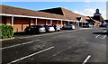
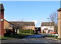
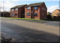
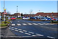
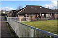
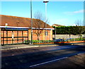
46 photos from this area
Area Information
Key information about the HR2 7EY including its size, population, and administrative classification.
- Area Type
- Postcode
- Area Size
- 1.0 hectares
- Population
- 1542
- Population Density
- 2899 people/km²
House Prices in HR2 7EY
30
Properties
£127,545
Average Sold Price
£42,500
Lowest Price
£235,000
Highest Price
Showing 30 properties
| Address | Type | Beds | Baths | Last Sale Price | Last Sale Date | |
|---|---|---|---|---|---|---|
| 111 Waterfield Road, Hereford, HR2 7EY | Terraced | 3 | 1 | £235,000 | Sep 2024 | |
| 85 Waterfield Road, Hereford, HR2 7EY | house | 3 | 1 | £195,000 | May 2023 | |
| 105 Waterfield Road, Hereford, HR2 7EY | Semi-detached | 3 | 1 | £188,000 | Feb 2023 | |
| 131 Waterfield Road, Hereford, HR2 7EY | house | - | - | £150,000 | Sep 2021 | |
| 99 Waterfield Road, Hereford, HR2 7EY | Terraced | 3 | - | £150,000 | Aug 2017 | |
| 91 Waterfield Road, Hereford, HR2 7EY | house | 3 | 1 | £121,000 | Oct 2012 | |
| 79 Waterfield Road, Hereford, HR2 7EY | Terraced | - | - | £118,500 | Oct 2005 | |
| 73 Waterfield Road, Hereford, HR2 7EY | Terraced | - | - | £85,000 | Jan 2003 | |
| 95 Waterfield Road, Hereford, HR2 7EY | Terraced | - | - | £64,000 | Mar 2002 | |
| 89 Waterfield Road, Hereford, HR2 7EY | Terraced | - | - | £54,000 | Sep 1999 |
Page 1 of 3
Energy Efficiency in HR2 7EY
Amenities
Schools
| Rank | School | Type | Entry gender | Ages |
|---|
Explore more schools in this area
Go to Schools tabDemographics
Household Size
Family (3-5 people)
most common
Accommodation Type
Houses
most common
Tenure
46
majority
Ethnic Group
White
most common
Religion
N/A
most common
Household Composition
N/A
most common
Age
47
median
Adults (30-64 years)
most common
Household Deprivation
N/A
with no deprivation
NS-SEC
19
in Lower managerial occupations
Explore more demographic insights in this area
Go to Demographics tabPlanning
Planning Constraints
- Flood RiskPremium
- Ramsar Wetland SitesPremium
- Area of Outstanding Natural BeautyPremium
- Protected Nature ReservePremium
- Protected WoodlandPremium