Area Overview for HR2 7UT
Photos of HR2 7UT


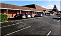
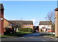
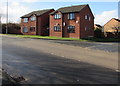
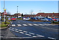
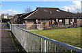
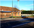
46 photos from this area
Area Information
Key information about the HR2 7UT including its size, population, and administrative classification.
- Area Type
- Postcode
- Area Size
- 7687 m²
- Population
- 1542
- Population Density
- 2899 people/km²
House Prices in HR2 7UT
23
Properties
£119,234
Average Sold Price
£39,250
Lowest Price
£220,000
Highest Price
Showing 23 properties
| Address | Type | Beds | Baths | Last Sale Price | Last Sale Date | |
|---|---|---|---|---|---|---|
| 5 Mulberry Close, Belmont, HR2 7UT | Terraced | 2 | 1 | £195,000 | May 2025 | |
| 21 Mulberry Close, Belmont, HR2 7UT | Terraced | 2 | 1 | £180,000 | Feb 2025 | |
| 15 Mulberry Close, Belmont, HR2 7UT | Terraced | 2 | 1 | £212,000 | Nov 2024 | |
| 23 Mulberry Close, Belmont, HR2 7UT | Terraced | 3 | 1 | £220,000 | Jun 2024 | |
| 9 Mulberry Close, Belmont, HR2 7UT | Detached | 3 | 1 | £175,500 | Jun 2024 | |
| 1 Mulberry Close, Belmont, HR2 7UT | Terraced | 2 | 1 | £119,000 | Aug 2017 | |
| 18 Mulberry Close, Belmont, HR2 7UT | Detached | 1 | 1 | £122,000 | Mar 2015 | |
| 14 Mulberry Close, Belmont, HR2 7UT | house | 2 | - | £61,000 | Jan 2015 | |
| 11 Mulberry Close, Belmont, HR2 7UT | Terraced | 3 | - | £164,950 | Dec 2014 | |
| 10 Mulberry Close, Belmont, HR2 7UT | Terraced | 2 | 1 | £110,500 | May 2014 |
Page 1 of 3
Energy Efficiency in HR2 7UT
Amenities
Schools
| Rank | School | Type | Entry gender | Ages |
|---|
Explore more schools in this area
Go to Schools tabDemographics
Household Size
Family (3-5 people)
most common
Accommodation Type
Houses
most common
Tenure
46
majority
Ethnic Group
White
most common
Religion
N/A
most common
Household Composition
N/A
most common
Age
47
median
Adults (30-64 years)
most common
Household Deprivation
N/A
with no deprivation
NS-SEC
19
in Lower managerial occupations
Explore more demographic insights in this area
Go to Demographics tabPlanning
Planning Constraints
- Flood RiskPremium
- Ramsar Wetland SitesPremium
- Area of Outstanding Natural BeautyPremium
- Protected Nature ReservePremium
- Protected WoodlandPremium