Area Overview for DY5 2AJ
Photos of DY5 2AJ
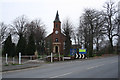
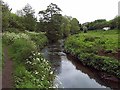
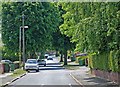
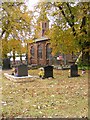
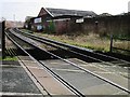
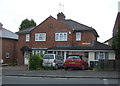
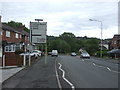
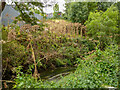
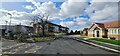
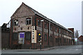
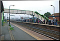
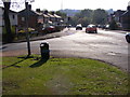
41 photos from this area
Area Information
Key information about the DY5 2AJ including its size, population, and administrative classification.
- Area Type
- Postcode
- Area Size
- 7496 m²
- Population
- 1665
- Population Density
- 5331 people/km²
House Prices in DY5 2AJ
26
Properties
£97,375
Average Sold Price
£18,630
Lowest Price
£180,000
Highest Price
Showing 26 properties
| Address | Type | Beds | Baths | Last Sale Price | Last Sale Date | |
|---|---|---|---|---|---|---|
| 2 Hillside Avenue, Quarry Bank, DY5 2AJ | house | 3 | - | £180,000 | Aug 2021 | |
| 12 Hillside Avenue, Quarry Bank, DY5 2AJ | house | - | - | £93,000 | Dec 2019 | |
| 4 Hillside Avenue, Quarry Bank, DY5 2AJ | Terraced | 3 | 2 | £91,000 | Jul 2019 | |
| 16 Hillside Avenue, Quarry Bank, DY5 2AJ | Semi-detached | 4 | - | £178,000 | Jun 2019 | |
| 26 Hillside Avenue, Quarry Bank, DY5 2AJ | Semi-detached | 4 | - | £111,500 | Oct 2015 | |
| 3 Hillside Avenue, Quarry Bank, DY5 2AJ | house | 3 | - | £98,500 | Jul 2011 | |
| 8 Hillside Avenue, Quarry Bank, DY5 2AJ | house | 3 | - | £92,500 | Apr 2011 | |
| 19 Hillside Avenue, Quarry Bank, DY5 2AJ | house | - | - | £68,000 | Sep 2009 | |
| 18 Hillside Avenue, Quarry Bank, DY5 2AJ | Semi-detached | - | - | £116,000 | Mar 2005 | |
| 11 Hillside Avenue, Quarry Bank, DY5 2AJ | Terraced | - | - | £24,000 | May 1996 |
Page 1 of 3
Energy Efficiency in DY5 2AJ
Amenities
Schools
| Rank | School | Type | Entry gender | Ages |
|---|
Explore more schools in this area
Go to Schools tabDemographics
Household Size
One person
most common
Accommodation Type
Houses
most common
Tenure
62
majority
Ethnic Group
White
most common
Religion
N/A
most common
Household Composition
N/A
most common
Age
47
median
Adults (30-64 years)
most common
Household Deprivation
N/A
with no deprivation
NS-SEC
25
in Lower managerial occupations
Explore more demographic insights in this area
Go to Demographics tabPlanning
Planning Constraints
- Flood RiskPremium
- Ramsar Wetland SitesPremium
- Area of Outstanding Natural BeautyPremium
- Protected Nature ReservePremium
- Protected WoodlandPremium