Area Overview for DY4 9RB
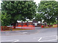
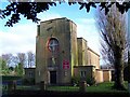
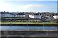
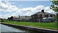
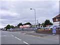
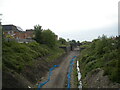
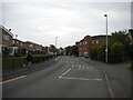
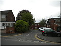
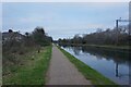
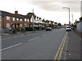
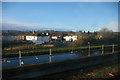
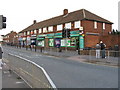
Photos of DY4 9RB
Area Information
DY4 9RB is a compact residential postcode in England, covering just 9,853 square metres and home to 2,066 residents. Its high population density—209,691 people per square kilometre—means it is a tightly knit community, ideal for those seeking proximity to amenities without the sprawl of larger towns. The area’s small size ensures that essential services, transport links, and local shops are within easy reach. Daily life here is shaped by its proximity to multiple railway stations, including Tipton and Dudley Port, which connect residents to broader networks. The median age of 47 suggests a mature, stable population, with many residents in their 30s to 60s. This demographic likely values convenience and established infrastructure, reflected in the area’s mix of retail options and transport connectivity. While the postcode is small, it offers a blend of practicality and accessibility, making it a viable choice for those prioritising ease of movement and community cohesion over expansive living spaces.
- Area Type
- Postcode
- Area Size
- 9853 m²
- Population
- 2066
- Population Density
- 5403 people/km²
DY4 9RB’s property market is characterised by a 46% home ownership rate, indicating that nearly half of the area’s housing is rented. This suggests a rental market that may cater to both long-term tenants and short-term occupants, though the exact balance between owner-occupied and rental properties is not specified. The predominant accommodation type is houses, which is unusual for a densely populated area of this size. This could imply a mix of small, family-friendly homes or multi-unit dwellings, though the data does not clarify this. For buyers, the small size of the postcode and its high density mean that property availability is limited, and proximity to amenities is a key selling point. The presence of multiple railway and metro stations nearby may also enhance the area’s appeal, particularly for commuters. However, the compact nature of DY4 9RB means that any property purchase would require careful consideration of space and location within the immediate vicinity.
House Prices in DY4 9RB
Showing 21 properties
| Address | Type | Beds | Baths | Last Sale Price | Last Sale Date | |
|---|---|---|---|---|---|---|
| 2 Brookes Meadow, Tipton, DY4 9RB | house | 3 | 2 | £230,000 | Sep 2025 | |
| 8 Brookes Meadow, Tipton, DY4 9RB | Detached | 3 | 2 | £270,000 | Apr 2025 | |
| 14 Brookes Meadow, Tipton, DY4 9RB | house | - | - | £272,500 | Jul 2024 | |
| 4 Brookes Meadow, Tipton, DY4 9RB | Terraced | 3 | 3 | £177,000 | May 2024 | |
| 22 Brookes Meadow, Tipton, DY4 9RB | house | 4 | 2 | £310,000 | Oct 2023 | |
| 30 Brookes Meadow, Tipton, DY4 9RB | house | - | - | £170,000 | Apr 2021 | |
| 6 Brookes Meadow, Tipton, DY4 9RB | Terraced | 3 | 1 | £177,000 | Nov 2020 | |
| 28 Brookes Meadow, Tipton, DY4 9RB | Terraced | 2 | 1 | £135,000 | Jun 2018 | |
| 5 Brookes Meadow, Tipton, DY4 9RB | Detached | 4 | 2 | £247,000 | Dec 2017 | |
| 18 Brookes Meadow, Tipton, DY4 9RB | Detached | 3 | 1 | £210,000 | Oct 2017 |
Energy Efficiency in DY4 9RB
Living in DY4 9RB offers access to a range of local amenities, from retail to transport, all within practical reach. The area is served by five retail outlets, including Co-op Upper, Heron Princes, and Morrisons Daily, providing everyday shopping convenience. For transport, residents have five railway stations, such as Tipton and Dudley Port, along with metro stops like Wednesbury Parkway and Wednesbury Great Western Street. These connections facilitate easy travel to nearby towns and cities. While the area lacks explicit mentions of parks or leisure facilities, the density of retail and transport options suggests a focus on practicality and accessibility. The presence of multiple shops and transport hubs likely contributes to a sense of convenience, though those seeking expansive green spaces or cultural amenities may need to look beyond the immediate postcode. The lifestyle here is defined by proximity and efficiency, catering to those who prioritise ease of access over sprawling environments.
Amenities
Schools
| Rank | School | Type | Entry gender | Ages |
|---|
Explore more schools in this area
Go to Schools tabDemographics
The population of DY4 9RB skews towards adults aged 30 to 64, with a median age of 47. This indicates a community of working-age individuals and families, many of whom may be raising children or nearing retirement. Home ownership rates stand at 46%, meaning nearly half of the housing stock is rented, suggesting a mix of owner-occupied and rental properties. The predominant accommodation type is houses, which, combined with the high population density, implies a compact, possibly multi-generational living environment. The majority of residents identify as White, reflecting the area’s demographic makeup. The high population density—over 200,000 people per square kilometre—could influence quality of life, with potential challenges in space and community resources. However, the presence of multiple retail and transport hubs nearby may mitigate these pressures, offering convenience that offsets density-related constraints.
Household Size
Accommodation Type
Tenure
Ethnic Group
Religion
Household Composition
Age
Household Deprivation
NS-SEC
Explore more demographic insights in this area
Go to Demographics tabPlanning
Planning Constraints
- Flood RiskPremium
- Ramsar Wetland SitesPremium
- Area of Outstanding Natural BeautyPremium
- Protected Nature ReservePremium
- Protected WoodlandPremium