Area Overview for DY4 9RF
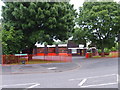
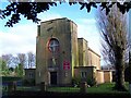
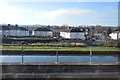
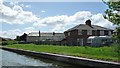
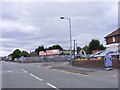
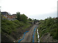
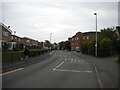
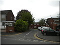
Photos of DY4 9RF
Area Information
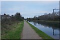
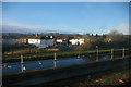
DY4 9RF is a small, tightly packed residential postcode in England, covering just 3,693 square metres. With a population of 2,066 people, it is one of the most densely populated areas in the country, at 559,509 people per square kilometre. This compact cluster of homes suggests a close-knit community, though its size means it is more of a micro-locale than a sprawling suburb. The area is likely to feel intimate, with limited space for expansion. Its proximity to rail and metro networks, including Tipton and Dudley Port stations, suggests it is well-served for commuters. While the data does not specify local landmarks or green spaces, the absence of environmental constraints like AONB or protected woodlands indicates it is a straightforward residential zone. Living here would involve navigating a high population density, but the area’s connectivity and proximity to retail and transport hubs may offset this. It is a place where daily life revolves around nearby amenities and the rhythm of public transport.
- Area Type
- Postcode
- Area Size
- 3693 m²
- Population
- 2066
- Population Density
- 5403 people/km²
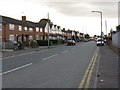
The property market in DY4 9RF is characterised by a mix of owner-occupied and rental homes, with 46% of residents owning their properties. The accommodation type is primarily houses, which is notable given the area’s high population density. This suggests a focus on family homes or small multi-generational units, possibly with gardens or shared spaces. However, the limited area size—just over 3,600 square metres—means the housing stock is constrained, and the immediate surroundings may offer little additional development potential. For buyers, this could mean competition for a small number of properties, with prices likely influenced by proximity to transport links like Tipton Railway Station. The predominance of houses over flats or apartments may appeal to those seeking traditional living arrangements, though the high density may impact privacy or outdoor space.
House Prices in DY4 9RF
Showing 12 properties
| Address | Type | Beds | Baths | Last Sale Price | Last Sale Date | |
|---|---|---|---|---|---|---|
| 8 House Meadow, Tipton, DY4 9RF | Detached | 4 | - | £240,000 | Jun 2017 | |
| 5 House Meadow, Tipton, DY4 9RF | Detached | - | - | £182,995 | Jun 2013 | |
| 7 House Meadow, Tipton, DY4 9RF | Detached | - | - | £192,995 | Jun 2012 | |
| 4 House Meadow, Tipton, DY4 9RF | Detached | - | - | £180,000 | May 2012 | |
| 3 House Meadow, Tipton, DY4 9RF | Detached | - | - | £219,995 | May 2012 | |
| 2 House Meadow, Tipton, DY4 9RF | Detached | - | - | £215,000 | Apr 2012 | |
| 1 House Meadow, Tipton, DY4 9RF | Detached | - | - | £174,995 | Apr 2012 | |
| 6 House Meadow, Tipton, DY4 9RF | Detached | 4 | 2 | £219,995 | Mar 2012 | |
| 9 House Meadow, Tipton, DY4 9RF | house | - | - | - | - | |
| 11 House Meadow, Tipton, DY4 9RF | house | - | - | - | - |
Energy Efficiency in DY4 9RF
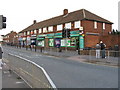
Daily life in DY4 9RF is supported by a range of nearby amenities, including five retail outlets such as Co-op Upper, Heron Princes, and Farmfoods Tipton. These shops provide essential services, from groceries to general retail, reducing the need for long trips. The area’s rail and metro stations—Tipton, Dudley Port, and Coseley—offer easy access to public transport, connecting residents to broader networks for work, leisure, or shopping. While the data does not specify parks or leisure facilities, the absence of environmental constraints like AONB or protected woodlands suggests the area is focused on residential and commercial use. The compact layout means amenities are within practical reach, though the high density may mean limited green spaces. For residents, this balance of retail, transport, and connectivity creates a functional, if space-constrained, lifestyle.
Amenities
Schools
| Rank | School | Type | Entry gender | Ages |
|---|
Explore more schools in this area
Go to Schools tabDemographics
The community in DY4 9RF is predominantly middle-aged, with a median age of 47 and the most common age range being 30–64 years. This suggests a population of working-age adults, many of whom may be employed locally or commuting to nearby towns. Home ownership is relatively low at 46%, indicating that nearly half of residents rent their homes. The accommodation type is primarily houses, which is unusual for a high-density area, hinting at a mix of semi-detached or terraced properties. The predominant ethnic group is White, with no data provided on other demographics. The high population density—over half a million people per square kilometre—raises questions about housing pressures, though the small area size may limit the need for expansion. For residents, this density could mean limited private outdoor space but strong social cohesion in a compact setting.
Household Size
Accommodation Type
Tenure
Ethnic Group
Religion
Household Composition
Age
Household Deprivation
NS-SEC
Explore more demographic insights in this area
Go to Demographics tabPlanning
Planning Constraints
- Flood RiskPremium
- Ramsar Wetland SitesPremium
- Area of Outstanding Natural BeautyPremium
- Protected Nature ReservePremium
- Protected WoodlandPremium