Area Overview for DY4 9PD
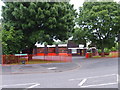
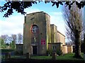
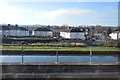
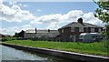
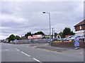
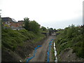
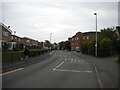
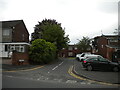
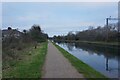
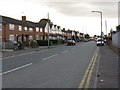
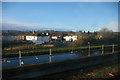
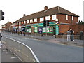
Photos of DY4 9PD
Area Information
DY4 9PD is a compact residential postcode in England, covering just 5,459 square metres and home to 2,066 residents. Its high population density of 378,447 people per square kilometre reflects a tightly knit community, though the area’s small size means it is a focused cluster of homes rather than a sprawling suburb. The postcode is served by multiple rail and metro stations, including Tipton Railway Station and Wednesbury Parkway, offering straightforward access to nearby towns. Daily life here is shaped by proximity to retail outlets like Co-op Upper and Farmfoods Tipton, as well as the convenience of public transport. While the area is not defined by natural landscapes, its practical layout and connectivity make it appealing for those prioritising accessibility over open spaces. The median age of 47 suggests a stable, mature population, with a strong presence of adults aged 30–64. Living in DY4 9PD means navigating a balance between urban convenience and the quieter rhythms of a smaller community, where local amenities and transport links are within easy reach.
- Area Type
- Postcode
- Area Size
- 5459 m²
- Population
- 2066
- Population Density
- 5403 people/km²
DY4 9PD is characterised by a housing stock that leans heavily towards owner-occupied homes, with 46% of properties owned by residents. The predominant accommodation type is houses, which is unusual in areas where flats or semi-detached homes are more typical. This suggests a market that caters to families or individuals seeking private, standalone properties rather than rental-focused developments. Given the small area size and limited number of homes, the property market here is likely to be niche, with limited scope for expansion. Buyers should consider that the area’s compact nature means competition for properties could be fierce, particularly for those prioritising proximity to transport links. The presence of rail and metro stations nearby may enhance the appeal of homes in DY4 9PD, offering commuters flexibility. However, the owner-occupation rate implies that rental opportunities may be limited, making it a less attractive option for those seeking short-term tenancies.
House Prices in DY4 9PD
Showing 9 properties
| Address | Type | Beds | Baths | Last Sale Price | Last Sale Date | |
|---|---|---|---|---|---|---|
| 5 Upper Church Lane, Tipton, DY4 9PD | house | - | - | £328,000 | Dec 2020 | |
| 3A Upper Church Lane, Tipton, DY4 9PD | Detached | 4 | 2 | £236,000 | Jul 2018 | |
| 2 Upper Church Lane, Tipton, DY4 9PD | Detached | 4 | 2 | £251,500 | Feb 2017 | |
| 3 Upper Church Lane, Tipton, DY4 9PD | Detached | 4 | 3 | £224,995 | Jun 2013 | |
| 2A Upper Church Lane, Tipton, DY4 9PD | house | - | - | £175,000 | May 2013 | |
| 4 Upper Church Lane, Tipton, DY4 9PD | house | - | - | £229,995 | Apr 2013 | |
| 1A Upper Church Lane, Tipton, DY4 9PD | Detached | 4 | 2 | £229,995 | Feb 2011 | |
| 1 Upper Church Lane, Tipton, DY4 9PD | house | - | - | £214,995 | Dec 2010 | |
| 6 Upper Church Lane, Tipton, DY4 9PD | Land | - | - | - | - |
Energy Efficiency in DY4 9PD
Living in DY4 9PD offers access to a range of local amenities within practical reach. The area is served by five retail outlets, including Co-op Upper, Heron Princes, and Farmfoods Tipton, providing everyday shopping needs. While the postcode itself does not include major parks or leisure facilities, its proximity to rail and metro stations—such as Coseley Railway Station and Wednesbury Great Western Street—connects residents to larger urban centres with more extensive recreational options. The presence of multiple transport hubs also means that dining, entertainment, and cultural activities in nearby towns are easily accessible. The character of daily life here is defined by convenience: residents can shop locally, commute efficiently, and leverage nearby infrastructure for broader opportunities. However, the absence of named parks or green spaces within the postcode suggests that outdoor leisure may require travel to adjacent areas.
Amenities
Schools
| Rank | School | Type | Entry gender | Ages |
|---|
Explore more schools in this area
Go to Schools tabDemographics
The population of DY4 9PD is predominantly composed of adults aged 30–64, with a median age of 47. This suggests a community of established professionals and families, rather than a younger or elderly demographic. Home ownership sits at 46%, indicating a mix of owner-occupied properties and rental homes. The accommodation type is primarily houses, which is notable in a region where flats or terraced housing might be more common. The predominant ethnic group is White, reflecting the broader demographic trends of the area. While the data does not specify diversity metrics beyond this, the age profile and housing stock suggest a community focused on stability and long-term residency. The absence of specific deprivation data means the quality of life here cannot be fully assessed, but the age range and home ownership figures imply a relatively settled population with established routines and local ties.
Household Size
Accommodation Type
Tenure
Ethnic Group
Religion
Household Composition
Age
Household Deprivation
NS-SEC
Explore more demographic insights in this area
Go to Demographics tabPlanning
Planning Constraints
- Flood RiskPremium
- Ramsar Wetland SitesPremium
- Area of Outstanding Natural BeautyPremium
- Protected Nature ReservePremium
- Protected WoodlandPremium