Area Overview for DY4 8SS
Photos of DY4 8SS
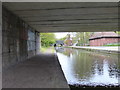
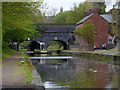

91 photos from this area
Area Information
Key information about the DY4 8SS including its size, population, and administrative classification.
- Area Type
- Postcode
- Area Size
- 5736 m²
- Population
- 1767
- Population Density
- 3482 people/km²
House Prices in DY4 8SS
10
Properties
£120,417
Average Sold Price
£45,000
Lowest Price
£210,000
Highest Price
Showing 10 properties
| Address | Type | Beds | Baths | Last Sale Price | Last Sale Date | |
|---|---|---|---|---|---|---|
| 111 Victoria Road, Tipton, DY4 8SS | Terraced | 4 | 2 | £210,000 | Aug 2024 | |
| 109 Victoria Road, Tipton, DY4 8SS | house | 3 | 1 | £125,000 | Aug 2017 | |
| 107 Victoria Road, Tipton, DY4 8SS | house | 4 | - | £112,500 | Jun 2016 | |
| 113 Victoria Road, Tipton, DY4 8SS | Terraced | - | - | £135,000 | Mar 2006 | |
| 101 Victoria Road, Tipton, DY4 8SS | Terraced | - | - | £95,000 | Dec 2004 | |
| 117 Victoria Road, Tipton, DY4 8SS | house | - | - | £45,000 | Dec 1996 | |
| Flat, 99 Victoria Road, Tipton, DY4 8SS | Flat | - | - | - | - | |
| 105 Victoria Road, Tipton, DY4 8SS | Terraced | - | - | - | - | |
| 115 Victoria Road, Tipton, DY4 8SS | house | - | - | - | - | |
| 103 Victoria Road, Tipton, DY4 8SS | house | - | - | - | - |
Energy Efficiency in DY4 8SS
Amenities
Schools
| Rank | School | Type | Entry gender | Ages |
|---|
Explore more schools in this area
Go to Schools tabDemographics
Household Size
Family (3-5 people)
most common
Accommodation Type
Houses
most common
Tenure
42
majority
Ethnic Group
White
most common
Religion
N/A
most common
Household Composition
N/A
most common
Age
47
median
Adults (30-64 years)
most common
Household Deprivation
N/A
with no deprivation
NS-SEC
18
in Lower managerial occupations
Explore more demographic insights in this area
Go to Demographics tabPlanning
Planning Constraints
- Flood RiskPremium
- Ramsar Wetland SitesPremium
- Area of Outstanding Natural BeautyPremium
- Protected Nature ReservePremium
- Protected WoodlandPremium