Area Overview for DY4 8RP
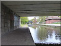
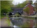
Photos of DY4 8RP


Area Information
DY4 8RP is a compact residential postcode in England, covering just 1.2 hectares and home to 1,761 residents. Its high population density of 141,062 people per square kilometre reflects a tightly knit community, where proximity to amenities and services is a defining feature. The area’s character is shaped by its mix of local shops, transport links, and schools, making it practical for daily life. With a median age of 47 and a population skewed toward adults aged 30–64, the community is mature and stable. Most residents own their homes, though 37% of properties are owner-occupied, suggesting a balance between long-term residents and renters. The area’s small size means it is likely integrated with nearby towns, offering access to broader networks while maintaining a focused, local identity. For buyers, DY4 8RP presents a blend of convenience and density, ideal for those prioritising accessibility over expansive living space. Its proximity to Dudley Port Railway Station and nearby retail hubs like Morrisons Daily and Co-op Upper ensures that essentials are within easy reach.
- Area Type
- Postcode
- Area Size
- 1.2 hectares
- Population
- 1761
- Population Density
- 7904 people/km²
The property market in DY4 8RP is characterised by a 37% home ownership rate, with houses forming the majority of accommodation types. This suggests a market skewed toward rental properties, as owner-occupation is less prevalent than in many comparable areas. The small area size means the housing stock is limited, likely concentrated in a few clusters of homes rather than sprawling developments. For buyers, this could mean competition for available properties, particularly given the proximity to transport and retail hubs. The predominance of houses over flats may appeal to those seeking traditional family homes, though the low ownership rate indicates a strong rental sector. Prospective buyers should consider the area’s compact nature, which may limit options for larger properties or developments. The mix of owner-occupied and rented homes also implies a dynamic market, where demand could fluctuate based on local employment opportunities and broader economic trends.
House Prices in DY4 8RP
Showing 63 properties
| Address | Type | Beds | Baths | Last Sale Price | Last Sale Date | |
|---|---|---|---|---|---|---|
| 56 Park Lane East, Tipton, DY4 8RP | Terraced | 3 | 2 | £150,000 | Jun 2023 | |
| 88 Park Lane East, Tipton, DY4 8RP | Terraced | 3 | 1 | £150,000 | Jun 2023 | |
| 54 Park Lane East, Tipton, DY4 8RP | Terraced | 3 | 1 | £105,000 | May 2021 | |
| 62 Park Lane East, Tipton, DY4 8RP | Terraced | 3 | - | £88,000 | Nov 2016 | |
| 58 Park Lane East, Tipton, DY4 8RP | Terraced | - | - | £80,000 | Jul 2016 | |
| 73 Park Lane East, Tipton, DY4 8RP | house | - | - | £70,000 | Mar 2016 | |
| 77 Park Lane East, Tipton, DY4 8RP | house | - | - | £73,000 | Oct 2013 | |
| 67 Park Lane East, Tipton, DY4 8RP | Terraced | - | - | £64,000 | Jan 2013 | |
| 68 Park Lane East, Tipton, DY4 8RP | house | - | - | £91,000 | Nov 2009 | |
| 74 Park Lane East, Tipton, DY4 8RP | house | - | - | £95,000 | Apr 2008 |
Energy Efficiency in DY4 8RP
Daily life in DY4 8RP is shaped by its proximity to essential amenities. Within practical reach are retail outlets like Morrisons Daily, Co-op Upper, and Co-op Tipton, providing grocery and everyday shopping options. The area’s transport links, including Dudley Port Railway Station and nearby metro stops, make commuting and travel convenient. While parks and leisure facilities are not explicitly listed in the data, the absence of environmental constraints like AONB or protected woodlands suggests open spaces may be available nearby. The mix of retail and transport infrastructure supports a practical, community-focused lifestyle, ideal for those prioritising accessibility over expansive recreational areas. The presence of multiple schools and shops ensures that essentials are within easy reach, fostering a self-contained yet connected environment.
Amenities
Schools
Near DY4 8RP are two schools catering to different educational needs. St Martin’s CofE Primary School, rated ‘good’ by Ofsted, serves younger children, offering a solid foundation for primary education. Dudley Port School, a special school with a ‘satisfactory’ rating, provides tailored support for students with specific learning requirements. The presence of both a primary school and a special school suggests the area is well-suited for families with children of varying needs. However, the absence of secondary schools in the immediate vicinity may require families to look further afield for comprehensive education. The mix of school types ensures accessibility for diverse learner profiles, though parents should assess whether the available options align with their child’s long-term educational goals.
| Rank | School | Type | Entry gender | Ages |
|---|
Explore more schools in this area
Go to Schools tabDemographics
The population of DY4 8RP is predominantly adults aged 30–64, with a median age of 47. This suggests a community of established professionals and families, rather than a younger or elderly demographic. Home ownership stands at 37%, which is relatively low compared to national averages, indicating a significant proportion of renters. The area is composed primarily of houses, reflecting a traditional housing stock rather than flats or apartments. The predominant ethnic group is White, though no further breakdown of diversity is provided in the data. The age profile and ownership figures suggest a mix of long-term residents and those in transitional housing phases. With no specific data on deprivation or income levels, the quality of life here appears to hinge on the availability of services and transport. The high population density, while practical for access to amenities, may influence the pace of life and community dynamics.
Household Size
Accommodation Type
Tenure
Ethnic Group
Religion
Household Composition
Age
Household Deprivation
NS-SEC
Explore more demographic insights in this area
Go to Demographics tabPlanning
Planning Constraints
- Flood RiskPremium
- Ramsar Wetland SitesPremium
- Area of Outstanding Natural BeautyPremium
- Protected Nature ReservePremium
- Protected WoodlandPremium