Area Overview for DY4 8UP
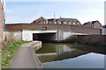
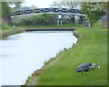
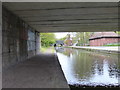
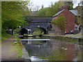
Photos of DY4 8UP


Area Information
Living in DY4 8UP means being part of a tightly knit residential cluster in England, where 1,767 people reside across 7,373 square metres. The area’s compact size fosters a close-knit community, with residents often within walking distance of local amenities. The population density of 239,642 people per square kilometre reflects a mix of long-standing residents and those drawn to the area’s practicality. Daily life here balances suburban comfort with proximity to transport links and retail hubs. The median age of 47 suggests a mature demographic, with many residents in their prime working years. While the area lacks sprawling green spaces, its strategic location near Dudley, Tipton, and Coseley ensures easy access to larger towns for leisure, shopping, and employment. For those seeking a quiet yet connected lifestyle, DY4 8UP offers a blend of affordability and accessibility, though its small footprint means every decision about living here carries a sense of proximity to both neighbours and essential services.
- Area Type
- Postcode
- Area Size
- 7373 m²
- Population
- 1767
- Population Density
- 3482 people/km²
The property market in DY4 8UP is characterised by a 42% home ownership rate, with houses forming the majority of accommodation types. This suggests a mix of owner-occupied homes and rental properties, though the small area size means the housing stock is limited. The prevalence of houses rather than flats or apartments indicates a suburban or semi-rural character, which may appeal to buyers seeking more space than typical urban dwellings. However, the compact nature of DY4 8UP means buyers must consider proximity to surrounding areas for additional housing options. The low flood risk and absence of environmental constraints like AONB or protected woodlands make the area attractive for investment. For those prioritising security and stability, the property market here offers a blend of practicality and accessibility, though the limited size of the area may restrict choice for those seeking larger or more specialised homes.
House Prices in DY4 8UP
Showing 14 properties
| Address | Type | Beds | Baths | Last Sale Price | Last Sale Date | |
|---|---|---|---|---|---|---|
| 72 Coneygree Road, Tipton, DY4 8UP | Semi-detached | 3 | 1 | £230,000 | Nov 2023 | |
| 70 Coneygree Road, Tipton, DY4 8UP | Semi-detached | 3 | 2 | £150,000 | Sep 2020 | |
| 1 Coneygree Road, Tipton, DY4 8UP | house | 3 | 1 | £143,000 | Dec 2017 | |
| 5 Coneygree Road, Tipton, DY4 8UP | Semi-detached | 3 | 1 | £119,000 | Jan 2017 | |
| 69 Coneygree Road, Tipton, DY4 8UP | Semi-detached | 3 | - | £147,000 | Oct 2016 | |
| 12A Coneygree Road, Tipton, DY4 8UP | Semi-detached | 3 | 1 | £101,000 | Mar 2015 | |
| 9 Coneygree Road, Tipton, DY4 8UP | house | - | - | £175,000 | May 2013 | |
| 11 Coneygree Road, Tipton, DY4 8UP | Semi-detached | 3 | 1 | £70,000 | Jun 2012 | |
| 7 Coneygree Road, Tipton, DY4 8UP | house | 3 | 1 | £105,000 | Oct 2010 | |
| 3 Coneygree Road, Tipton, DY4 8UP | house | 3 | - | £185,000 | Jul 2004 |
Energy Efficiency in DY4 8UP
Daily life in DY4 8UP is shaped by its proximity to essential amenities. Retail options include major supermarkets such as Morrisons Daily, Co-op Tipton, and Tesco Dudley, ensuring residents have access to groceries, household goods, and convenience services. The area’s rail network, with stations like Dudley Port and Tipton, connects residents to larger towns and cities, facilitating both work and leisure travel. Metro stops like Wednesbury Parkway add flexibility for commuters. While the data does not mention parks or leisure facilities, the presence of multiple retail and transport hubs suggests a lifestyle focused on practicality and connectivity. The compact nature of the area means residents can reach these amenities quickly, though those seeking expansive green spaces may need to look further afield. For those valuing convenience over isolation, DY4 8UP offers a straightforward, accessible way of life.
Amenities
Schools
The nearest school to DY4 8UP is Sacred Heart Primary School, which holds a good Ofsted rating. This primary school serves the local community, offering education for younger children within walking distance of many homes. While no secondary schools are listed in the data, the presence of a well-rated primary school may be a key draw for families. The absence of additional educational institutions suggests that parents may need to look to nearby towns like Dudley or Tipton for secondary schooling. For families prioritising early education, Sacred Heart’s good rating provides reassurance about the quality of teaching and facilities. However, buyers should consider the broader school network in the surrounding area when evaluating the long-term suitability of DY4 8UP for their children’s education.
| Rank | School | Type | Entry gender | Ages |
|---|
Explore more schools in this area
Go to Schools tabDemographics
DY4 8UP’s population skews towards adults aged 30–64, with a median age of 47. This suggests a community of established professionals and families, rather than students or retirees. Home ownership sits at 42%, indicating a mix of owner-occupied properties and rental units. The area’s accommodation is predominantly houses, which aligns with the typical housing stock in small English towns. The predominant ethnic group is White, reflecting the broader demographic patterns of the region. While no specific data on deprivation is provided, the high population density and limited housing stock may influence housing affordability and community dynamics. The age profile suggests a stable, working-age population, which could impact local services and amenities. For buyers, this demographic profile implies a market shaped by long-term residents and those prioritising family-friendly environments over transient lifestyles.
Household Size
Accommodation Type
Tenure
Ethnic Group
Religion
Household Composition
Age
Household Deprivation
NS-SEC
Explore more demographic insights in this area
Go to Demographics tabPlanning
Planning Constraints
- Flood RiskPremium
- Ramsar Wetland SitesPremium
- Area of Outstanding Natural BeautyPremium
- Protected Nature ReservePremium
- Protected WoodlandPremium