Area Overview for DE14 1DS
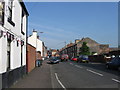
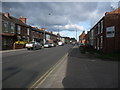
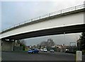
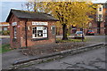
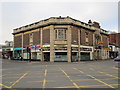
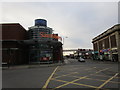
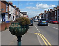
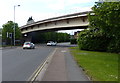
Photos of DE14 1DS

Area Information
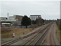
Living in DE14 1DS means inhabiting a compact, residential postcode area spanning 2.8 hectares. With a population of 1,432 people and a density of 1,032 people per square kilometre, this is a tightly knit community. The area’s small size suggests a focus on local, close-knit living, though its proximity to nearby towns may offer broader opportunities. Residents here are predominantly adults aged 30–64, with a median age of 47, indicating a mature demographic. The area is not densely developed, but its limited size means that daily life is likely shaped by nearby amenities and transport links. While no major landmarks or attractions are listed, the presence of three railway stations within practical reach—Burton, Tutbury & Hatton, and Willington—suggests connectivity to regional hubs. For those seeking a quiet, residential environment with access to essential services, DE14 1DS offers a mix of practicality and proximity. However, buyers should consider the area’s constraints, including its small footprint and the need to rely on surrounding towns for more extensive facilities.
- Area Type
- Postcode
- Area Size
- 2.8 hectares
- Population
- 1432
- Population Density
- 1032 people/km²
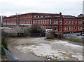
The property market in DE14 1DS is characterised by a low home ownership rate—just 26% of properties are owner-occupied—suggesting a rental-dominated market. The area’s accommodation is primarily houses, not flats, which may appeal to buyers seeking family homes or those prioritising private outdoor space. However, the small size of the postcode (2.8 hectares) means the housing stock is limited, potentially increasing competition for available properties. This could make the area attractive to investors or those looking for a specific type of property, but buyers should be aware of the constraints imposed by the area’s size. The dominance of rental properties may also mean that owner-occupied homes are fewer in number, possibly affecting long-term value stability. Given the lack of detailed data on property types or prices, prospective buyers should consider the surrounding areas for a broader range of options.
House Prices in DE14 1DS
Showing 4 properties
| Address | Type | Beds | Baths | Last Sale Price | Last Sale Date | |
|---|---|---|---|---|---|---|
| Adjacent Building, Kerry Foods Limited, 76 Mosley Street, Burton Upon Trent, DE14 1DS | general_industrial | - | - | - | - | |
| Food Production Line (meat), Kerry Foods Limited, 76 Mosley Street, Burton Upon Trent, DE14 1DS | Industrial | - | - | - | - | |
| Food Production Line (fish), Kerry Foods Limited, 76 Mosley Street, Burton Upon Trent, DE14 1DS | Industrial | - | - | - | - | |
| Staff Canteen, Kerry Foods Limited, 76 Mosley Street, Burton Upon Trent, DE14 1DS | Restaurant | - | - | - | - |
Energy Efficiency in DE14 1DS
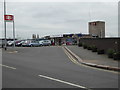
The lifestyle in DE14 1DS is shaped by its proximity to retail and transport hubs. Nearby supermarkets include Lidl Shobnall, Sainsburys Burton, and Iceland Burton, offering everyday shopping convenience. These stores cater to household needs, though the absence of local parks or leisure facilities means residents may need to travel for recreational activities. The three railway stations provide access to regional destinations, enhancing connectivity for commuters and those seeking cultural or social opportunities beyond the immediate area. The compact nature of the postcode means that daily life revolves around nearby towns, with the retail options and transport links serving as anchors. While the area lacks detailed information on dining or leisure spots, the presence of major supermarkets and rail access suggests a practical, service-oriented lifestyle. For buyers, this balance of convenience and necessity may be a key selling point, though it also highlights the need for broader exploration of surrounding areas.
Amenities
Schools
The nearest school to DE14 1DS is Christ Church Primary School, which serves the local community with a primary education offering. The school holds an Ofsted rating of “good,” indicating satisfactory standards in teaching, pupil progress, and overall management. As a primary school, it caters to younger families, though no secondary schools are listed in the data. This suggests that families may need to look beyond the immediate area for secondary education options. The presence of a single primary school with a positive rating is a key consideration for parents prioritising educational quality. However, the absence of secondary schools nearby means that students may need to commute to nearby towns, which could impact daily routines. For those valuing strong primary education, Christ Church Primary School provides a solid foundation, but broader school choices remain limited within DE14 1DS itself.
| Rank | School | Type | Entry gender | Ages |
|---|
Explore more schools in this area
Go to Schools tabDemographics
The community in DE14 1DS is defined by its age profile and household composition. With a median age of 47 and the majority of residents aged 30–64, this is a mature area with a strong presence of middle-aged adults. Only 26% of homes are owner-occupied, suggesting a rental market dominance, which may influence the types of properties available. The accommodation is primarily houses, not flats, reflecting a preference for single-family homes. The predominant ethnic group is White, though no specific diversity metrics are provided. The population density of 1,032 people per square kilometre indicates a compact, possibly mixed-use area, though the exact implications for social interaction or community cohesion are not quantified. The low home ownership rate may also reflect economic factors, such as affordability challenges or a transient population. For buyers, understanding the demographic profile is key to assessing whether the area aligns with their lifestyle or investment goals.
Household Size
Accommodation Type
Tenure
Ethnic Group
Religion
Household Composition
Age
Household Deprivation
NS-SEC
Explore more demographic insights in this area
Go to Demographics tabPlanning
Planning Constraints
- Flood RiskPremium
- Ramsar Wetland SitesPremium
- Area of Outstanding Natural BeautyPremium
- Protected Nature ReservePremium
- Protected WoodlandPremium