Area Overview for DE14 2DA
Photos of DE14 2DA

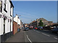
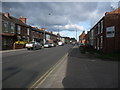
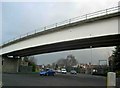
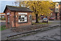
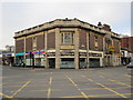
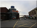
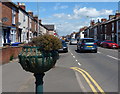
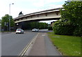
100 photos from this area
Area Information
Key information about the DE14 2DA including its size, population, and administrative classification.
- Area Type
- Postcode
- Area Size
- 1.5 hectares
- Population
- 2598
- Population Density
- 8745 people/km²
House Prices in DE14 2DA
34
Properties
-
Average Sold Price
-
Lowest Price
-
Highest Price
Showing 34 properties
| Address | Type | Beds | Baths | Last Sale Price | Last Sale Date | |
|---|---|---|---|---|---|---|
| 21A Borough Road, Burton Upon Trent, DE14 2DA | Maisonette | 1 | 3 | - | - | |
| Flat 1, 38 Borough Road, Burton Upon Trent, DE14 2DA | Flat | 1 | 1 | - | - | |
| Flat At, Former Station Hotel, Borough Road, Burton Upon Trent, DE14 2DA | undefined | - | - | - | - | |
| Orbit Housing Association, 37 Borough Road, Burton Upon Trent, DE14 2DA | retail_financial | - | - | - | - | |
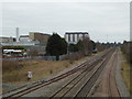
| Burton Upon Trent Railway Station, Borough Road, Burton Upon Trent, DE14 2DA | commercial | - | - | - | - | |
| Mayflower Restaurant, 12-14 Borough Road, Burton Upon Trent, DE14 2DA | restaurant_cafe | - | - | - | - | |
| Burton Angling Supplies, 30 Borough Road, Burton Upon Trent, DE14 2DA | retail_financial | - | - | - | - | |
| 37B Borough Road, Burton Upon Trent, DE14 2DA | Flat | - | - | - | - | |
| Flat 1, 10 Borough Road, Burton Upon Trent, DE14 2DA | Flat | - | - | - | - | |
| Store At, 2 Derby Street, Burton Upon Trent, DE14 2DA | shop | - | - | - | - |
Page 1 of 4
Energy Efficiency in DE14 2DA
Amenities
Schools
| Rank | School | Type | Entry gender | Ages |
|---|
Explore more schools in this area
Go to Schools tabDemographics
Household Size
Family (3-5 people)
most common
Accommodation Type
Houses
most common
Tenure
32
majority
Ethnic Group
White
most common
Religion
N/A
most common
Household Composition
N/A
most common
Age
47
median
Adults (30-64 years)
most common
Household Deprivation
N/A
with no deprivation
NS-SEC
17
in Lower managerial occupations
Explore more demographic insights in this area
Go to Demographics tabPlanning
Planning Constraints
- Flood RiskPremium
- Ramsar Wetland SitesPremium
- Area of Outstanding Natural BeautyPremium
- Protected Nature ReservePremium
- Protected WoodlandPremium