Area Overview for CV9 3AL
Photos of CV9 3AL
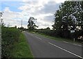
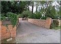
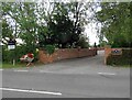
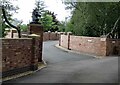

17 photos from this area
Area Information
Key information about the CV9 3AL including its size, population, and administrative classification.
- Area Type
- Postcode
- Area Size
- 1.9 hectares
- Population
- 1509
- Population Density
- 1309 people/km²
House Prices in CV9 3AL
23
Properties
£145,032
Average Sold Price
£110,000
Lowest Price
£180,195
Highest Price
Showing 23 properties
| Address | Type | Beds | Baths | Last Sale Price | Last Sale Date | |
|---|---|---|---|---|---|---|
| 69 Friary Road, Atherstone, CV9 3AL | Terraced | 2 | 1 | £172,000 | Dec 2022 | |
| 71 Friary Road, Atherstone, CV9 3AL | Terraced | 2 | 1 | £160,000 | May 2021 | |
| 76 Friary Road, Atherstone, CV9 3AL | Terraced | 3 | 1 | £165,000 | Feb 2021 | |
| 80 Friary Road, Atherstone, CV9 3AL | Semi-detached | 3 | 1 | £180,195 | Nov 2018 | |
| 84 Friary Road, Atherstone, CV9 3AL | Semi-detached | - | - | £130,000 | Feb 2017 | |
| 79 Friary Road, Atherstone, CV9 3AL | Semi-detached | 3 | 1 | £169,950 | Oct 2016 | |
| 72 Friary Road, Atherstone, CV9 3AL | Terraced | 2 | 1 | £121,759 | Apr 2016 | |
| 75 Friary Road, Atherstone, CV9 3AL | Terraced | 3 | 1 | £119,000 | Jan 2014 | |
| 73 Friary Road, Atherstone, CV9 3AL | Terraced | 2 | 1 | £110,000 | Jan 2014 | |
| 88 Friary Road, Atherstone, CV9 3AL | house | - | - | £142,500 | Sep 2013 |
Page 1 of 3
Energy Efficiency in CV9 3AL
Amenities
Schools
| Rank | School | Type | Entry gender | Ages |
|---|
Explore more schools in this area
Go to Schools tabDemographics
Household Size
Family (3-5 people)
most common
Accommodation Type
Houses
most common
Tenure
58
majority
Ethnic Group
White
most common
Religion
N/A
most common
Household Composition
N/A
most common
Age
47
median
Adults (30-64 years)
most common
Household Deprivation
N/A
with no deprivation
NS-SEC
16
in Lower managerial occupations
Explore more demographic insights in this area
Go to Demographics tabPlanning
Planning Constraints
- Flood RiskPremium
- Ramsar Wetland SitesPremium
- Area of Outstanding Natural BeautyPremium
- Protected Nature ReservePremium
- Protected WoodlandPremium